בעידן של גלובליזציה ודיגיטציה, הקהילה מבוססת-המקום הולכת ונחלשת, והזיקה הפיזית והתרבותית של התושב אל האדמה שבה הוא גר דועכת. בראשית התכנון הפיזי בישראל (כפי שתיאר האדריכל אריה שרון), החקלאות לא שימשה רק כמערכת כלכלית, אלא חוללה את הבסיס החברתי והמבנה הקהילתי של הטיפולוגיות ההתיישבותיות. אולם, תהליכי עיור מואצים במחצית השנייה של המאה הקודמת דחקו את השטחים החקלאיים מלב הערים לטובת ציפוף, תשתיות רכב ובלוקים של מגורים.
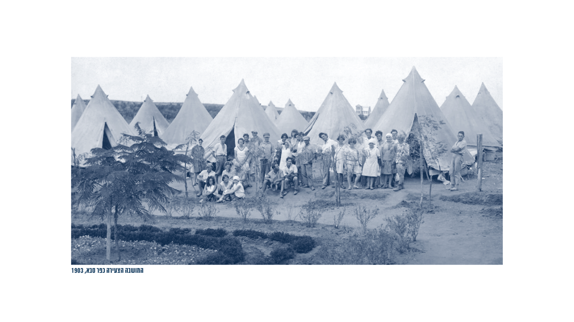
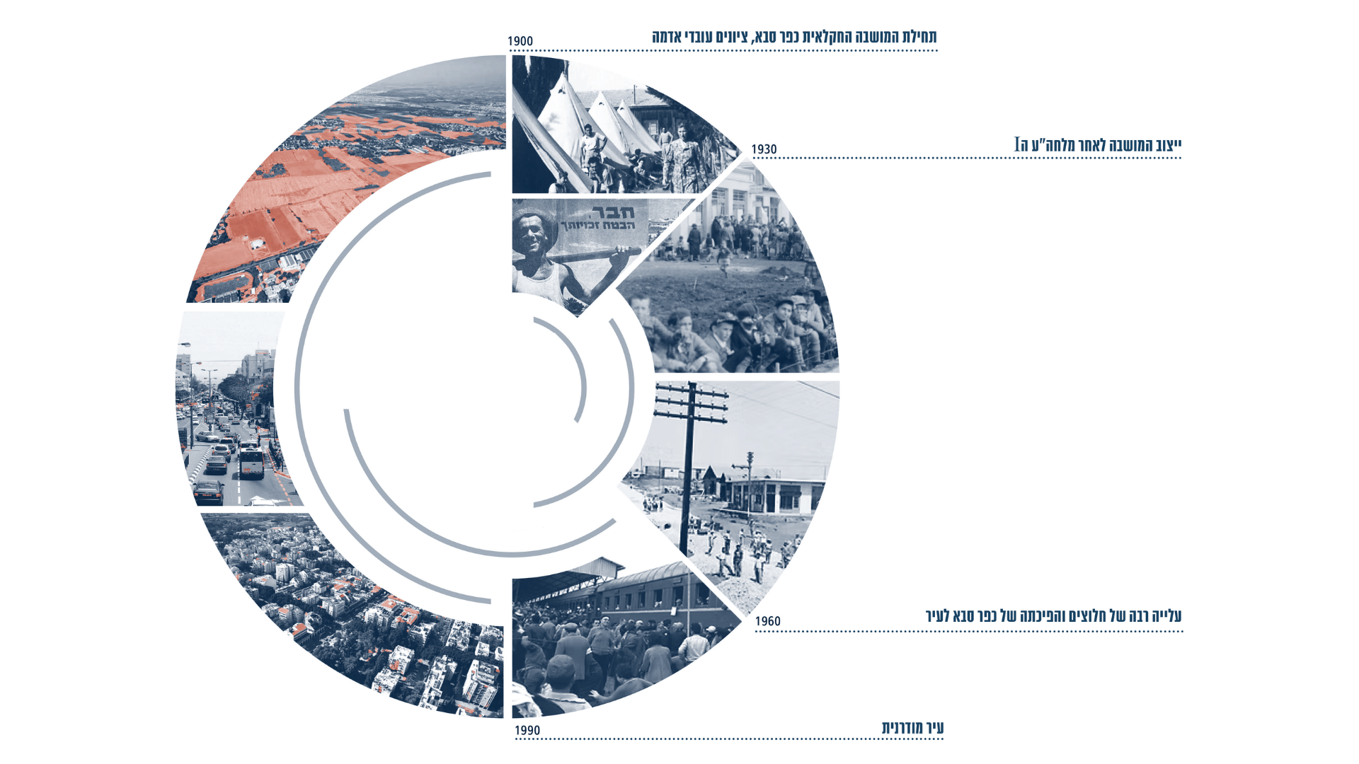
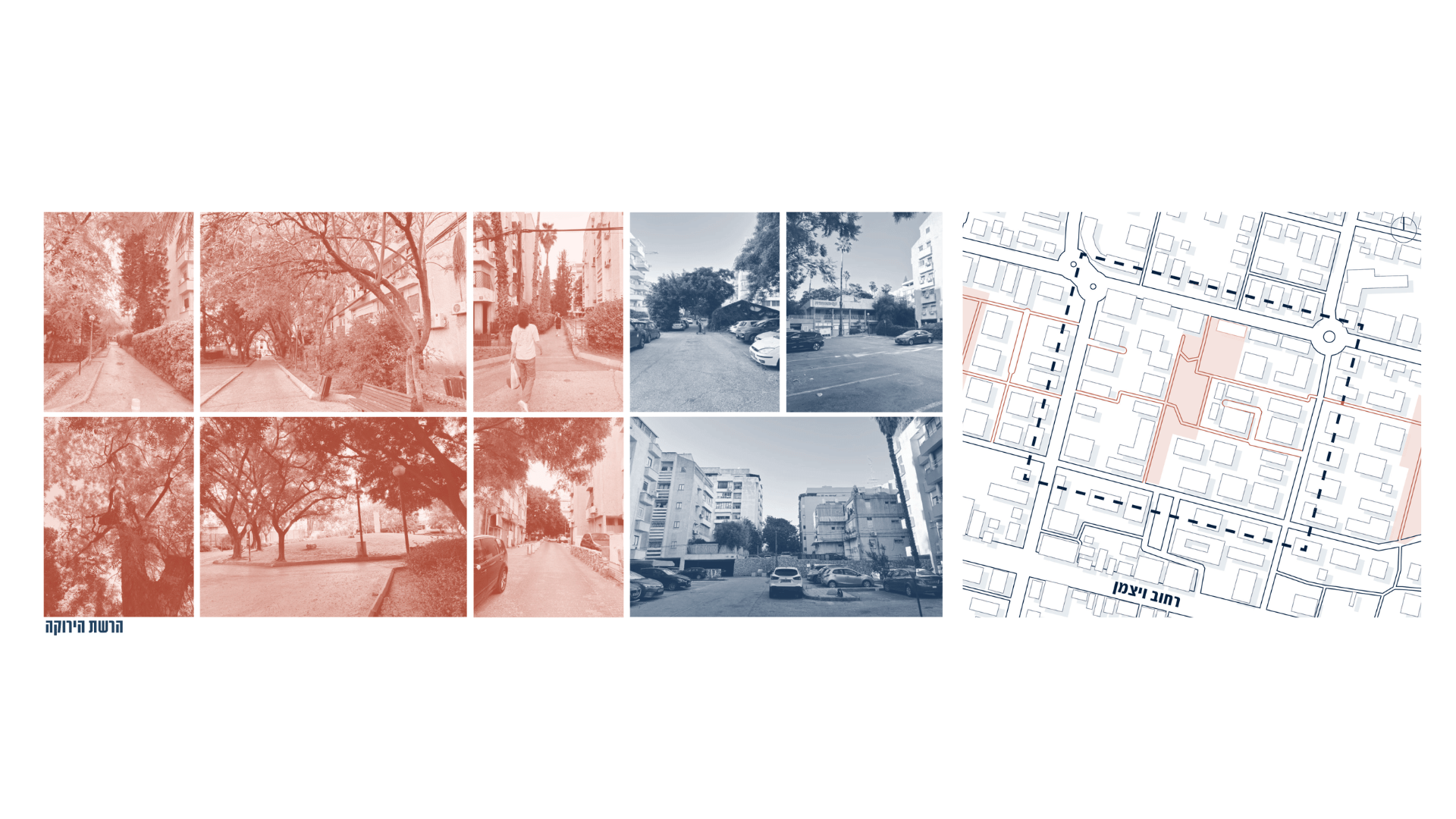
כפר סבא מהווה מקרה בוחן מובהק לתהליך זה: ממושבה חקלאית שהוקמה ב-1903 מתוך אידיאולוגיה של עיבוד האדמה, היא הוכרזה כעיר ב-1962 תוך הסטת הדגש מחקלאות לתעשייה ופיתוח עירוני. מחקר תכנוני זה מזהה פוטנציאל התערבות בתשתית עירונית קיימת – "הרשת הירוקה" שתוכננה בעיר על ידי יוסף קולודני בשנות ה-70 כרשת צירים הליכתית המחברת בין גינות ומבני ציבור.
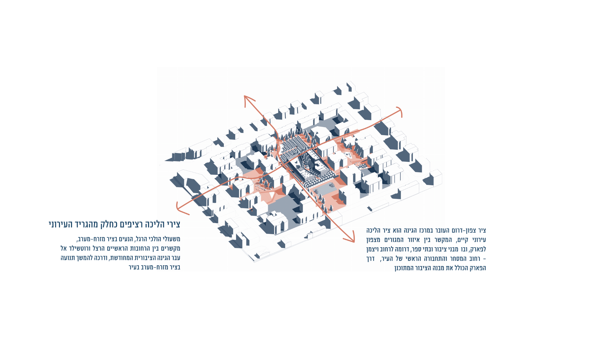
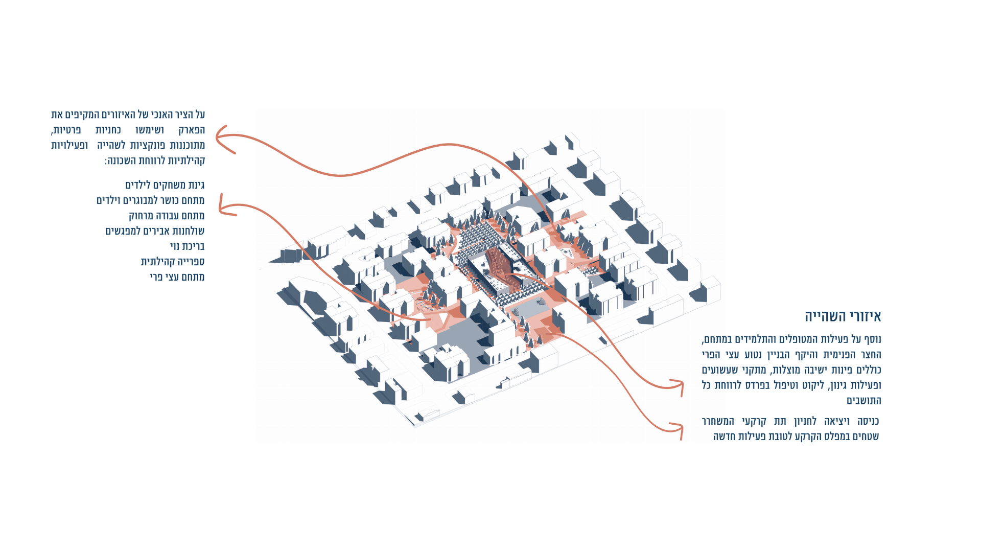
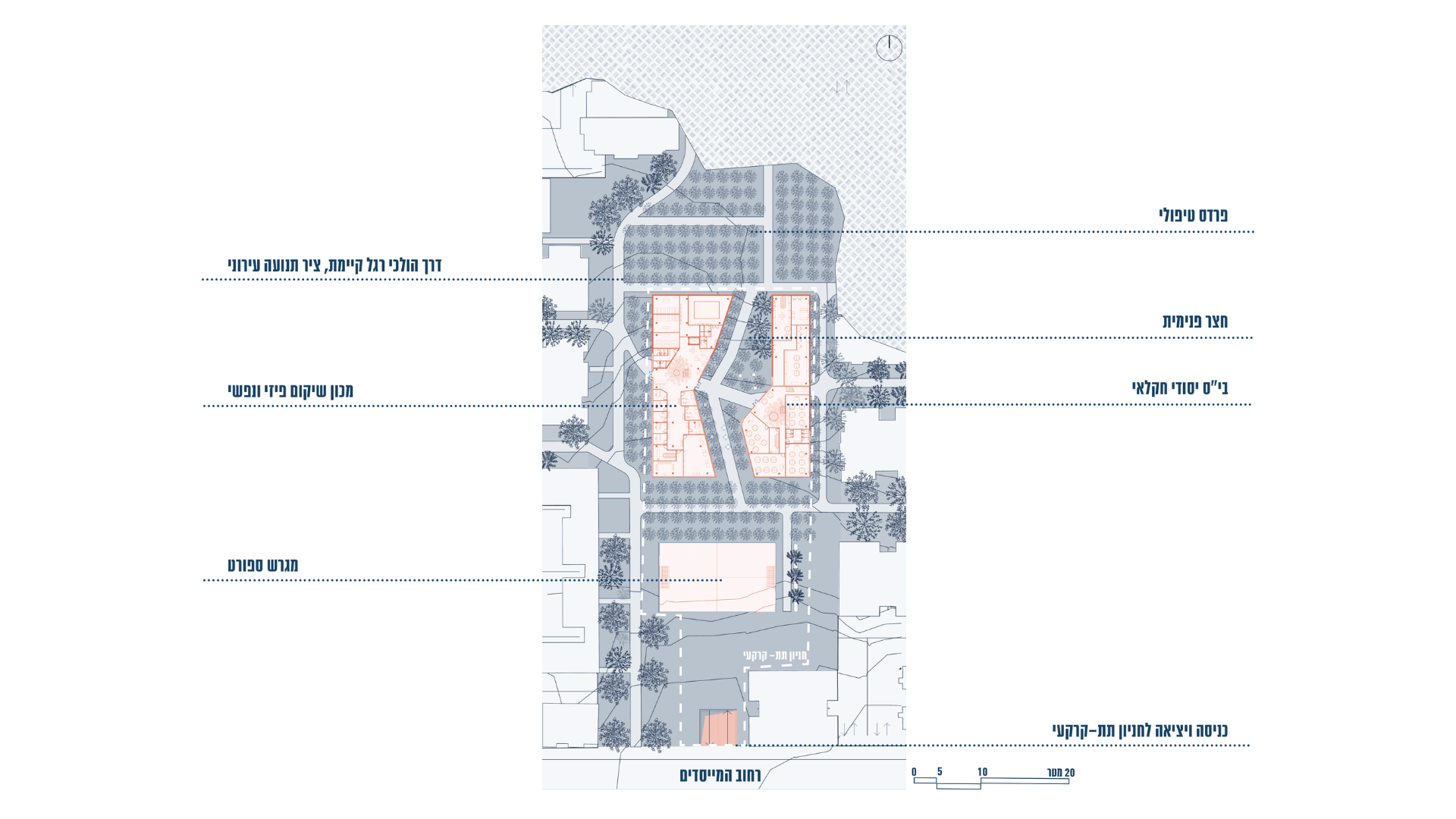
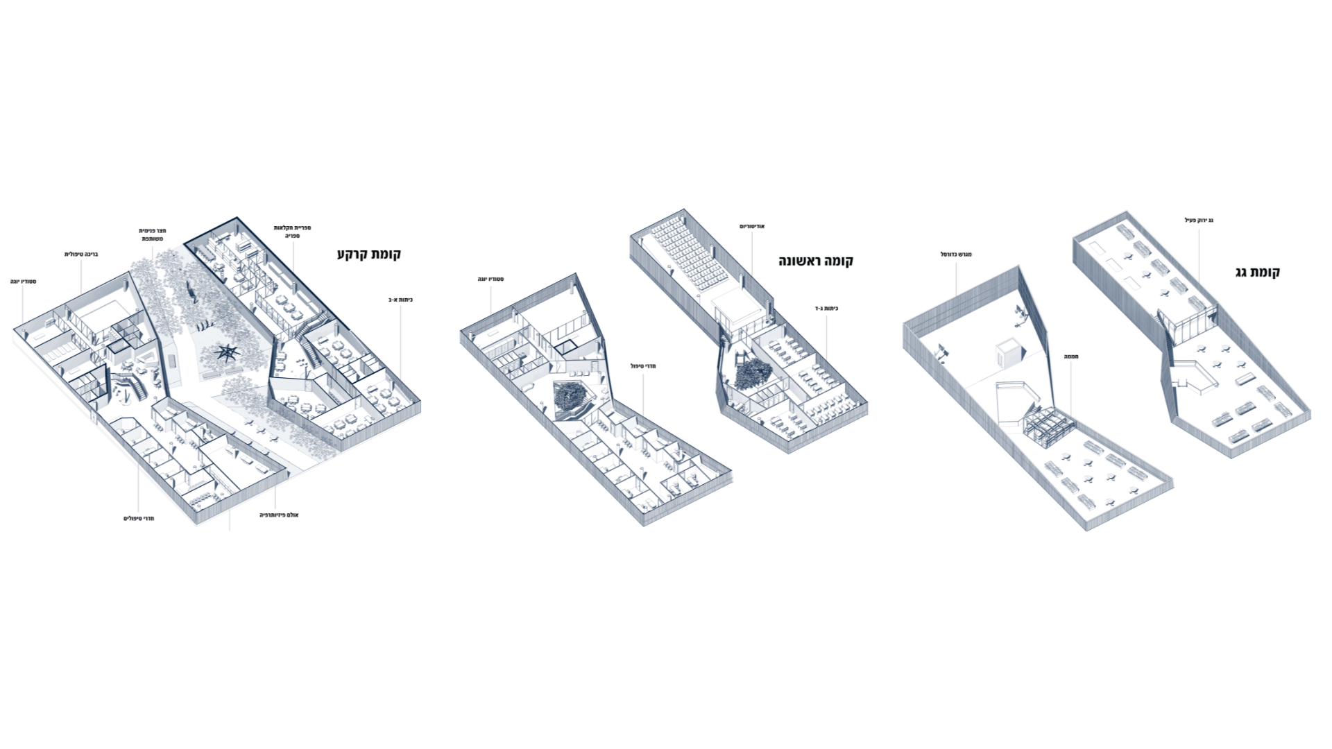
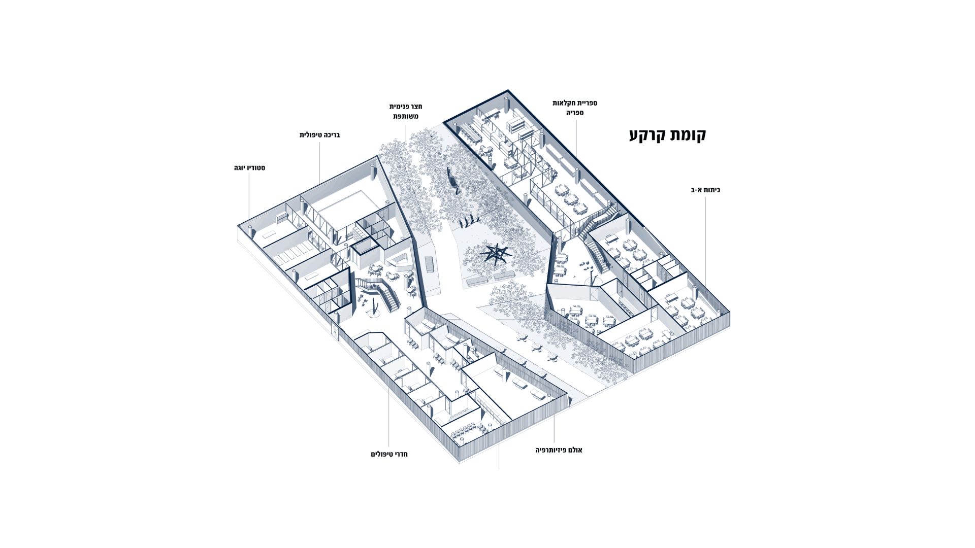
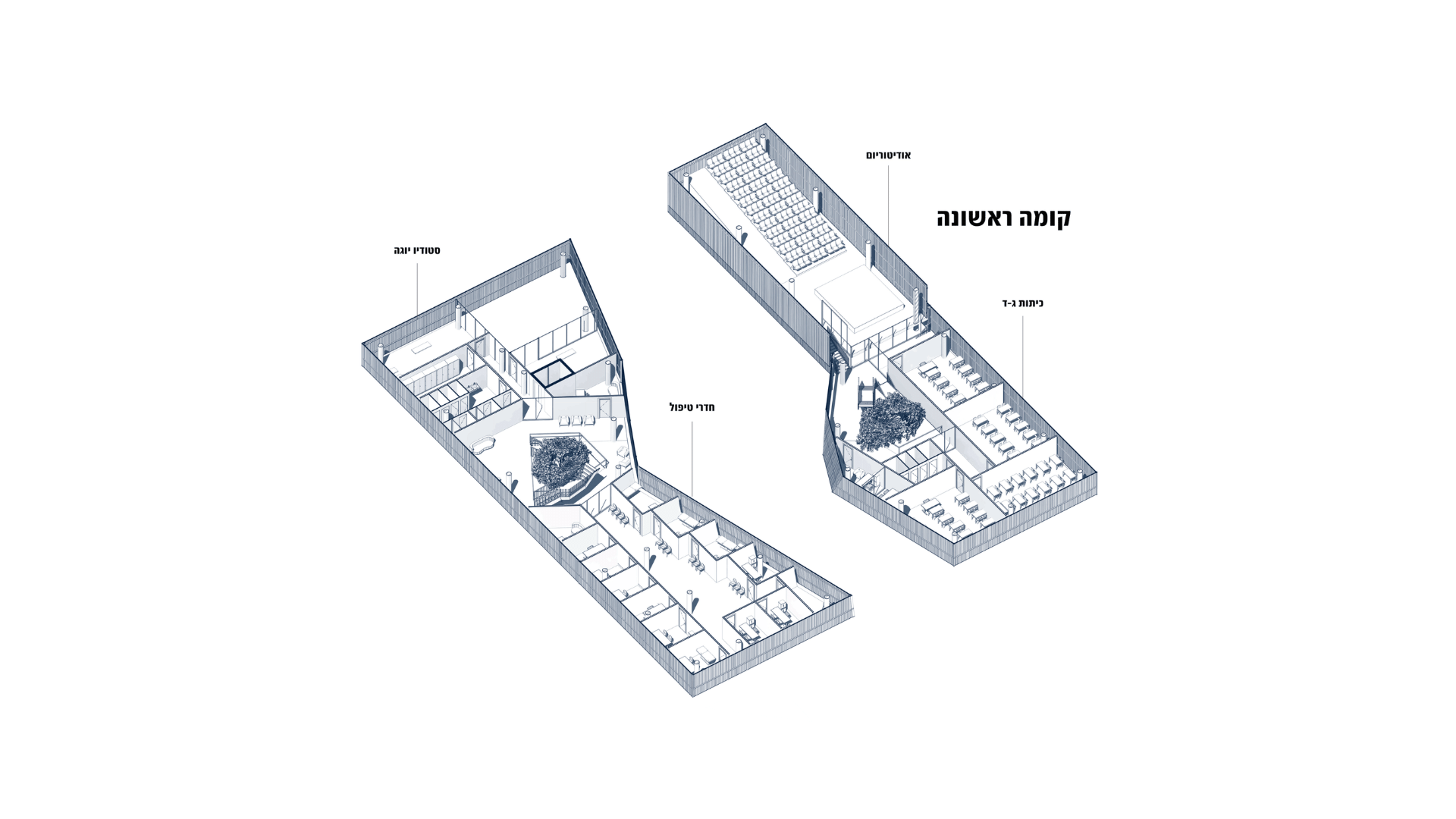
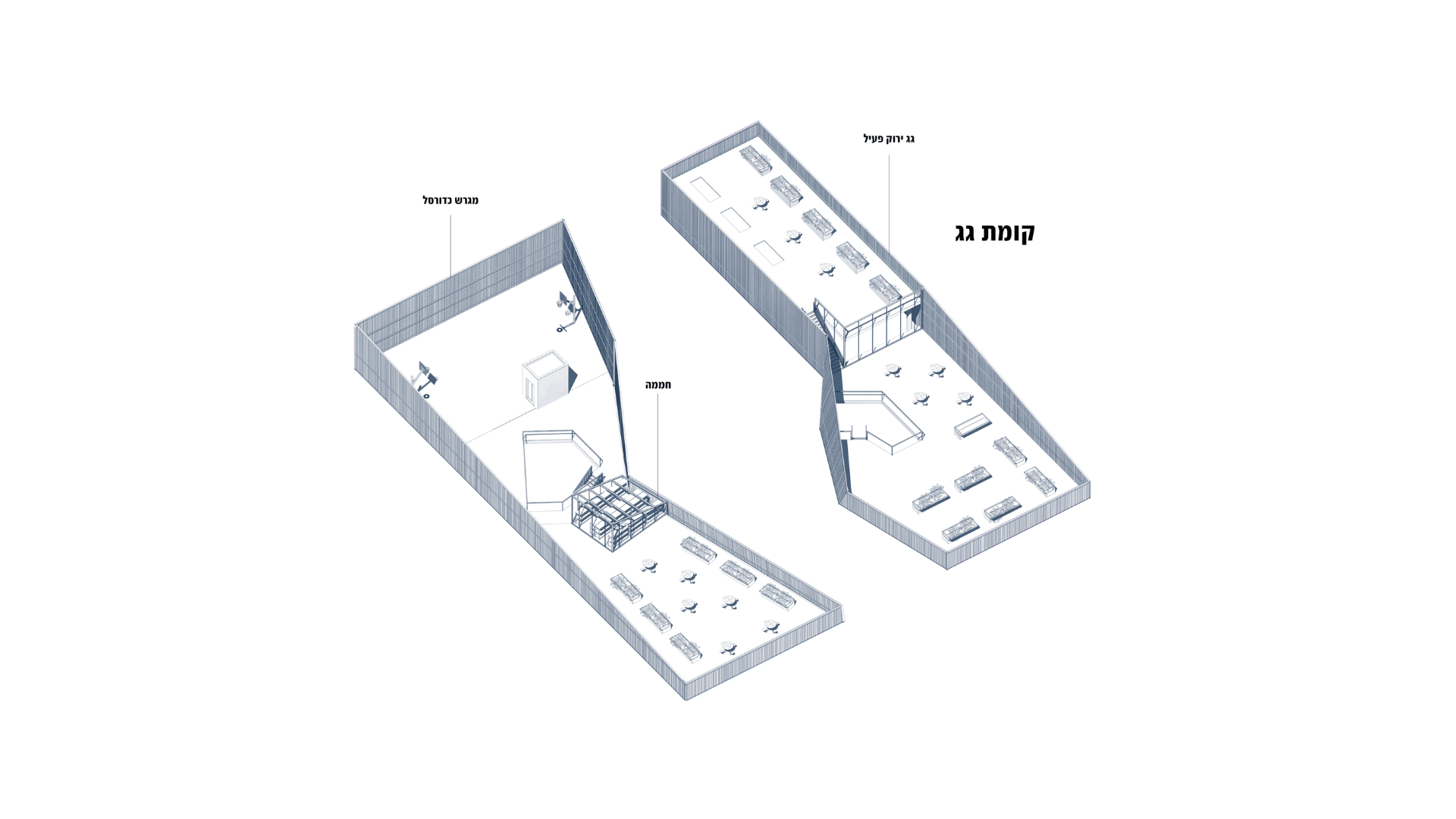
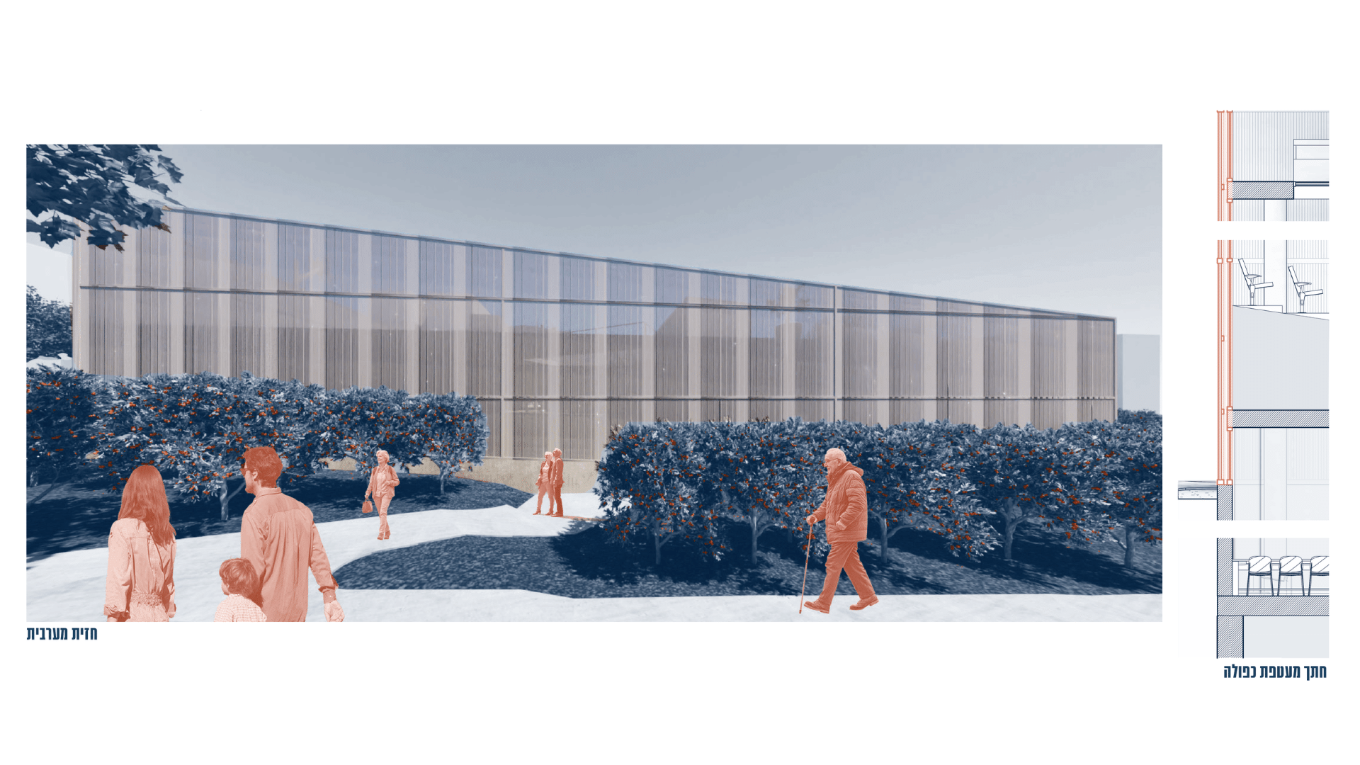
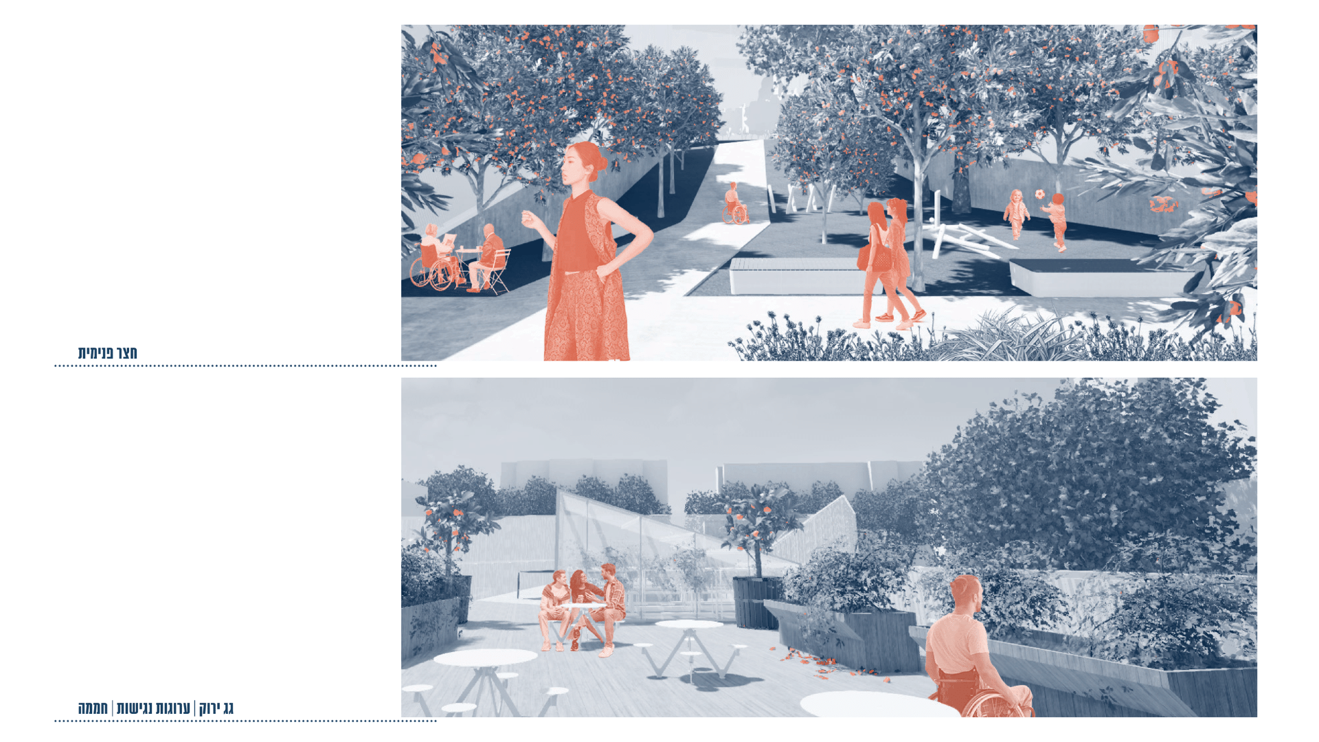
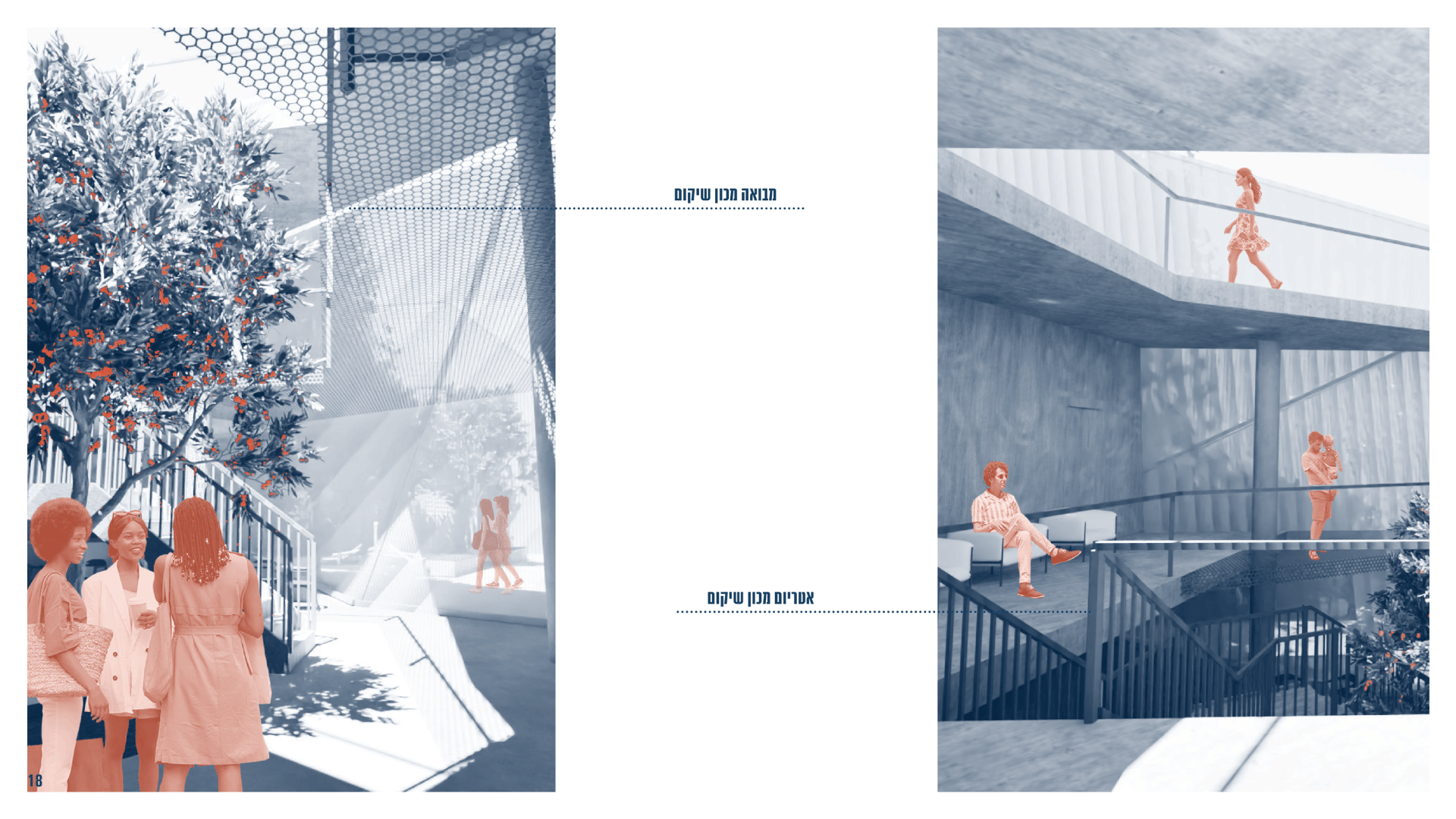
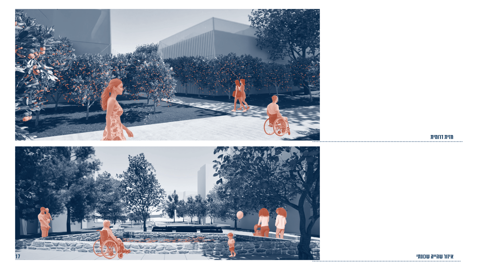
הפרויקט מתמקד במרכז העיר ומציע התערבות במרקם המגורים הקיים ובגריד העירוני, ומטרתו: להשיב למרחב הציבורי את תפקידו כמנוע קהילתי. בבסיס ההצעה עומד שחרור פני הקרקע. החניונים העיליים המרובים במגרשי הבניינים הפרטיים משוקעים אל התת-קרקע, ובמקומם מתפנה המרחב העירוני לטיוב סביבתי ולרווחת התושבים. דרכי "הרשת הירוקה" מורחבות ומוטמעים בהן אלמנטים חקלאיים וקהילתיים – כגון גינות פנאי, בריכה אקולוגית, מתקני כושר וספרייה קהילתית. במרכז הבלוק ניצב מבנה ציבור היברידי המשלב מכון שיקום פיזי ונפשי לצד בית ספר יסודי ייחודי, כאשר שתי הפרוגרמות חולקות פרדס טיפולי הממוקם בלב המבנה ומסביבו. תכנון מבוסס מפגש זה מעודד עירוב של אוכלוסיות מגוונות בלב המרחב הבלוקי ומעצים את גיבוש הקהילה המקומית. המהלך, הנע מקנה המידה האורבני ועד לקנה המידה המפורט, מתווה מתודולוגיה תכנונית (מעין "תכנית אב") להתערבות במרקמים עירוניים קיימים: זיהוי כשלים מרחביים ושילוב מחדש של ערכים חקלאיים-קהילתיים בלב העיר.
In an era of globalization and digitization, the place-based community is steadily eroding, along with the physical and cultural connection between residents and the land they inhabit. In the early days of physical planning in Israel (as described by architect Arieh Sharon), agriculture served not merely as an economic system, but as the foundational social engine and community framework of settlement typologies. However, accelerated urbanization processes in the second half of the twentieth century displaced agricultural land from city centers in favor of densification, vehicular infrastructure, and residential blocks.
Kfar Saba serves as a clear case study for this transformation: evolving from an agricultural colony founded in 1903 on the ideology of working the land, to a municipality declared a city in 1962, shifting its focus from agriculture to industrialization and urban development. This design research identifies an opportunity for intervention within an existing urban infrastructure—the "Green Network" designed by Yosef Kolodny in the 1970s as a pedestrian movement network linking public gardens and civic institutions.
Centered in the heart of Kfar Saba, the project proposes an architectural intervention within the existing residential fabric and urban grid, aiming to restore the public realm to its role as a community engine. At the core of the proposal is the liberation of the ground plane: surface parking lots scattered across private building plots are submerged underground, reclaiming urban space for environmental enhancement and resident well-being. The pathways of the "Green Network" are expanded to integrate agricultural and civic programs—including leisure gardens, an ecological pond, outdoor fitness amenities, and a community library. At the center of the block stands a hybrid public building combining a physical and mental rehabilitation center with a specialized elementary school, both sharing a therapeutic citrus orchard wrapped around and embedded within the structure. This encounter-driven design fosters the integration of diverse demographics within the residential block, strengthening local community cohesion. Operating from the urban scale down to the detailed architectural resolution, this intervention outlines a planning methodology (a master plan framework) for transforming existing urban fabrics: identifying spatial deficiencies and reintroducing agrarian-community values into the urban core.
في عصر العولمة والرقمنة، يضعف المجتمع المحلي القائم على المكان وتتراجع الروابط المادية والثقافية التي تجمع الساكن بالأرض التي يعيش عليها. في بدايات التخطيط العمراني في إسرائيل (كما وصفه المعماري أريه شارون)، لم تكن الزراعة مجرد نظام اقتصادي، بل شكلت المرتكز الاجتماعي والبنية المجتمعية للأنماط الاستيطانية. غير أن عمليات التمدن المتسارعة في النصف الثاني من القرن الماضي أزاحت المساحات الزراعية من قلب المدن لصالح التكثيف العمراني، والبنية التحتية للمركبات، والكتل السكنية.
تُعدّ كفر سابا حالة دراسية بارزة لهذا التحول: فمن مستعمرة زراعية تأسست عام 1903 بدافِع إيديولوجي يعتمد على فلاحة الأرض، أُعلنت مدينةً عام 1962 مع تحول التركيز من الزراعة إلى الصناعة والتطوير الحضري. يحدد هذا البحث التخطيطي فرصة للتدخل في بنية تحتية حضرية قائمة – "الشبكة الخضراء" التي صممها يوسف كولودني في السبعينيات كشبكة مسارات للمشاة تربط بين الحدائق والمرافق العامة.
يركز المشروع على مركز المدينة ويقترح تدخلاً معمارياً في النسيج السكني القائم والشبكة الحضرية، بهدف استعادة الفضاء العام لدوره كمحرك مجتمعي. يقوم جوهر المقترح على تحرير سطح الأرض: حيث تُنقَل مواقف السيارات السطحية في قسائم المباني الخاصة إلى أسفل الأرض، مما يحرر المساحة الحضرية لصالح التحسين البيئي ورفاهية السكان. كما تُوَسَّع مسارات "الشبكة الخضراء" وتُدْمَج فيها برامج زراعية ومجتمعية – مثل حدائق التنزه، والبركة البيئية، ومنشآت اللياقة البدنية، والمكتبة المجتمعية. وفي مركز المجمع السكني (البلوك)، يبرز مبنى عام هجين يجمع بين مركز للتأهيل البدني والنفسي ومدرسة ابتدائية فريدة، حيث يتشارك البرنامجان في بيارة علاجية (بستان حمضيات) تقع في قلب المبنى وتلتف حوله. يُعزز هذا التصميم القائم على التلاقي والتفاعل التداخل بين فئات سكانية متنوعة في قلب النسيج السكني، مما يقوي التماسك المجتمعي المحلي. هذا النهج، المتدرج من المقياس الحضري الشامل وصولاً إلى التفاصيل المعمارية، يضع منهجية تخطيطية (بمثابة "مخطط توجيهي") للتدخل في النُّسُج الحضرية القائمة: تشخيص الخلل المكاني، وإعادة دمج القيم الزراعية والمجتمعية في قلب المدينة.