הפרויקט מתחיל בשאלה היכן העיר נגמרת בתודעה שלנו. מתוך מחקר של מפות מנטליות של תל אביב עלה כי למרות שהעיר נתפסת כמערכת מחוברת ואינטנסיבית, היא נחווית גם כמרחב המחולק באמצעות גבולות. אחד הגבולות שחזרו במפות היה נחל הירקון – מרחב פתוח משמעותי בלב העיר, אשר בתודעה מצטמצם לעיתים לקו המסמן את סופה של העיר המוכרת ואת תחילתו של מרחב אחר.
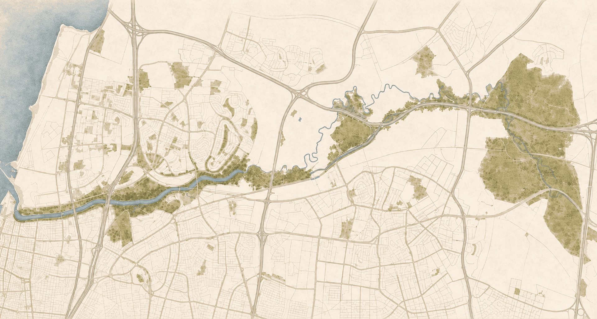
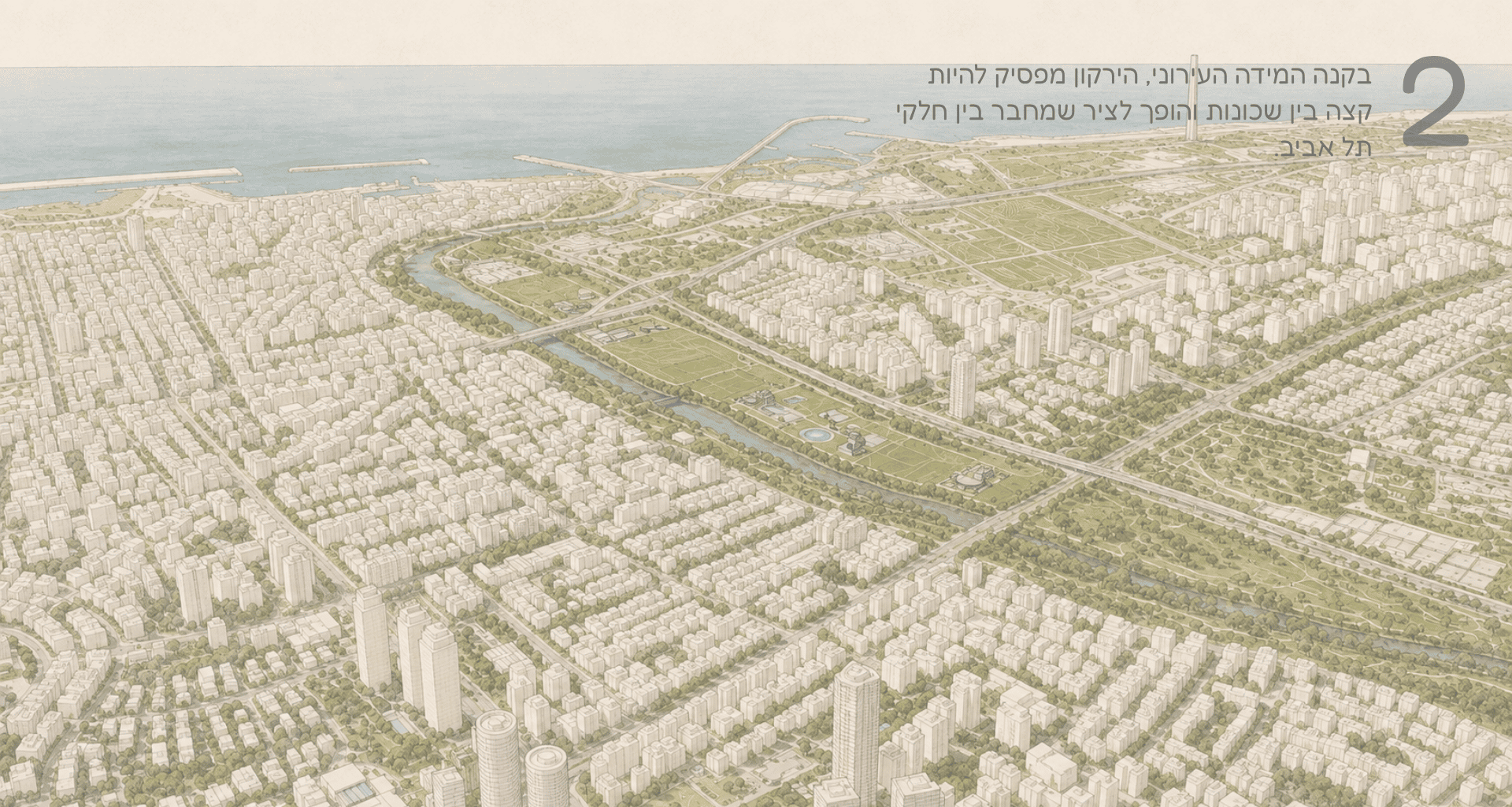
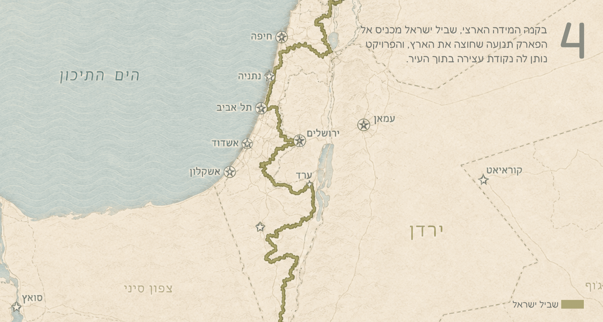
הירקון הוא מערכת רציפה החוצה את המטרופולין ומגיעה אל הים, אך בתוך תל אביב הוא מתפקד במקומות רבים כקו מפריד. הקשר בין העיר, הפארק והנחל חלקי, והמרחב אינו נחווה כרצף עירוני אחד. עם המשך התפתחות העיר צפונה והקמת הרובע החדש בשדה דב, עולה האפשרות לחשוב מחדש על הירקון – לא כקצה עירוני, אלא כמרחב מרכזי ומחבר.
הפרויקט מתמקד במקטע הספורטק ובגדה הצפונית של הירקון, שבה הפער בין הפוטנציאל של המרחב לבין האופן שבו הוא פועל כיום בולט במיוחד. שדרות רוקח, המרחק הגדול אל הנחל והאופי החשוף של הפארק יוצרים נתק בין המרקם העירוני, הפארק והמים. מתוך כך עולה שאלת הפרויקט: כיצד ניתן לא רק לאפשר מעבר אל הנחל, אלא להפוך את הדרך אליו למרחב עירוני בפני עצמו?
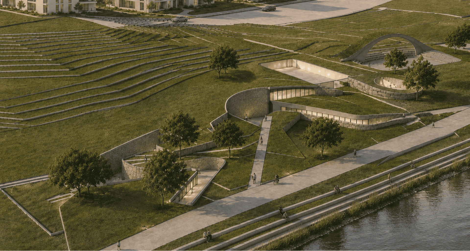
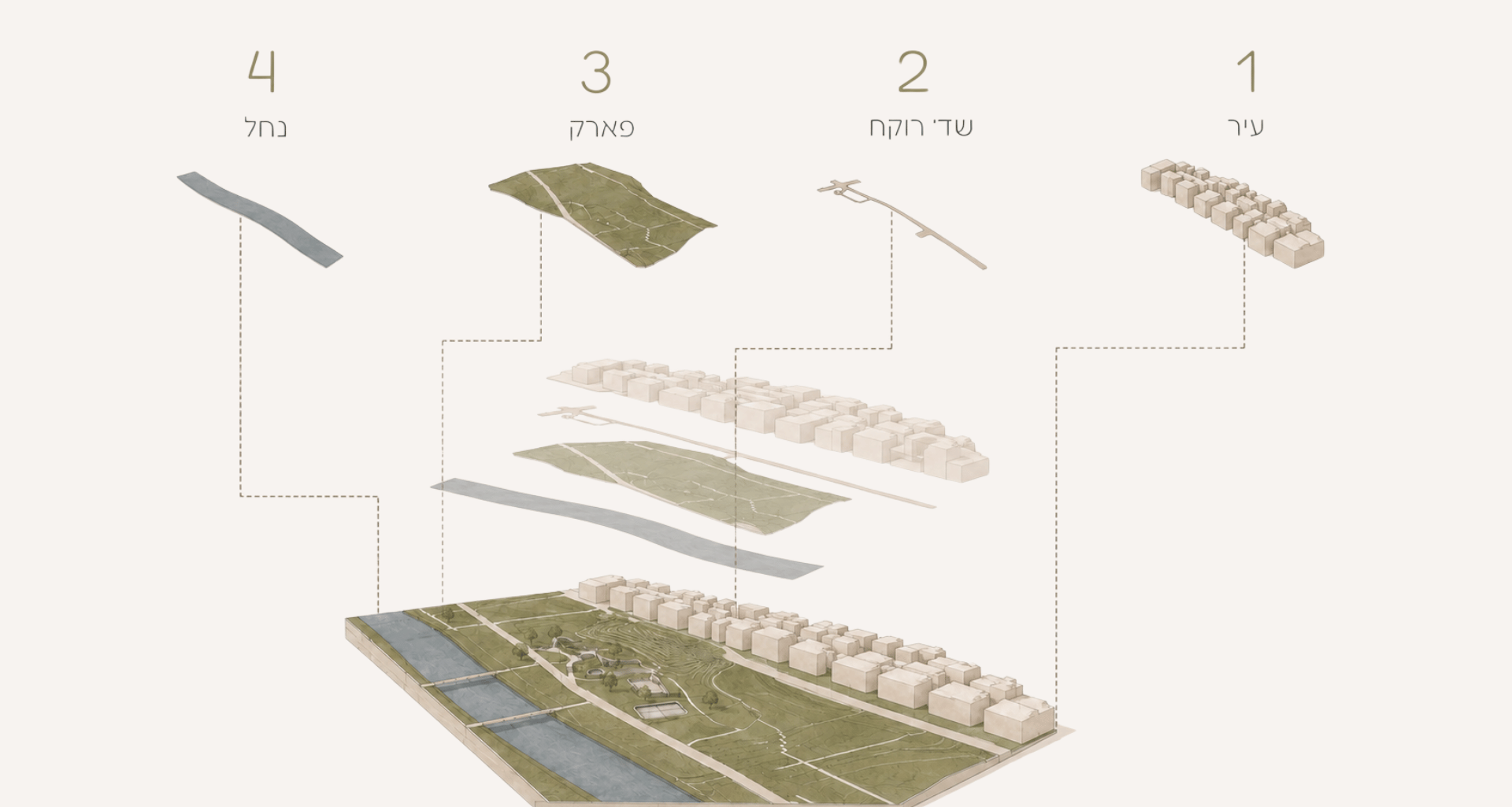
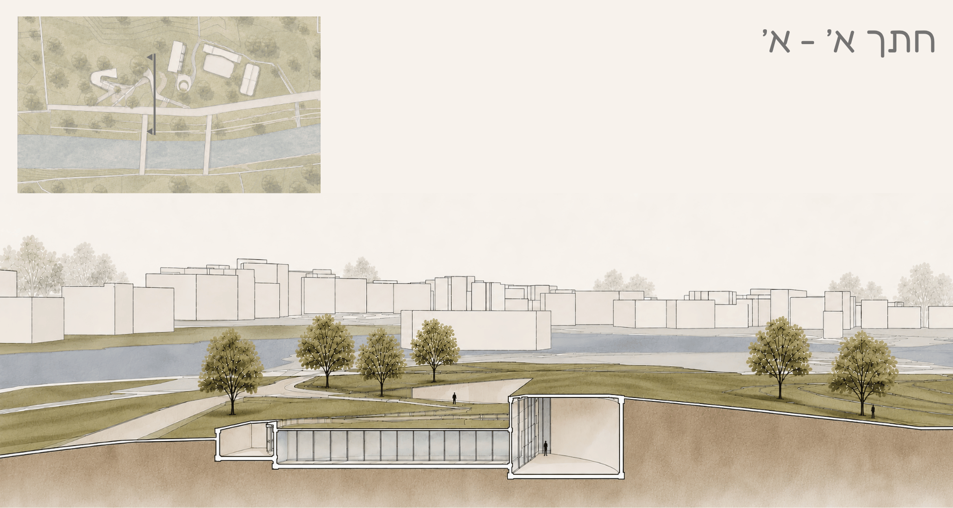
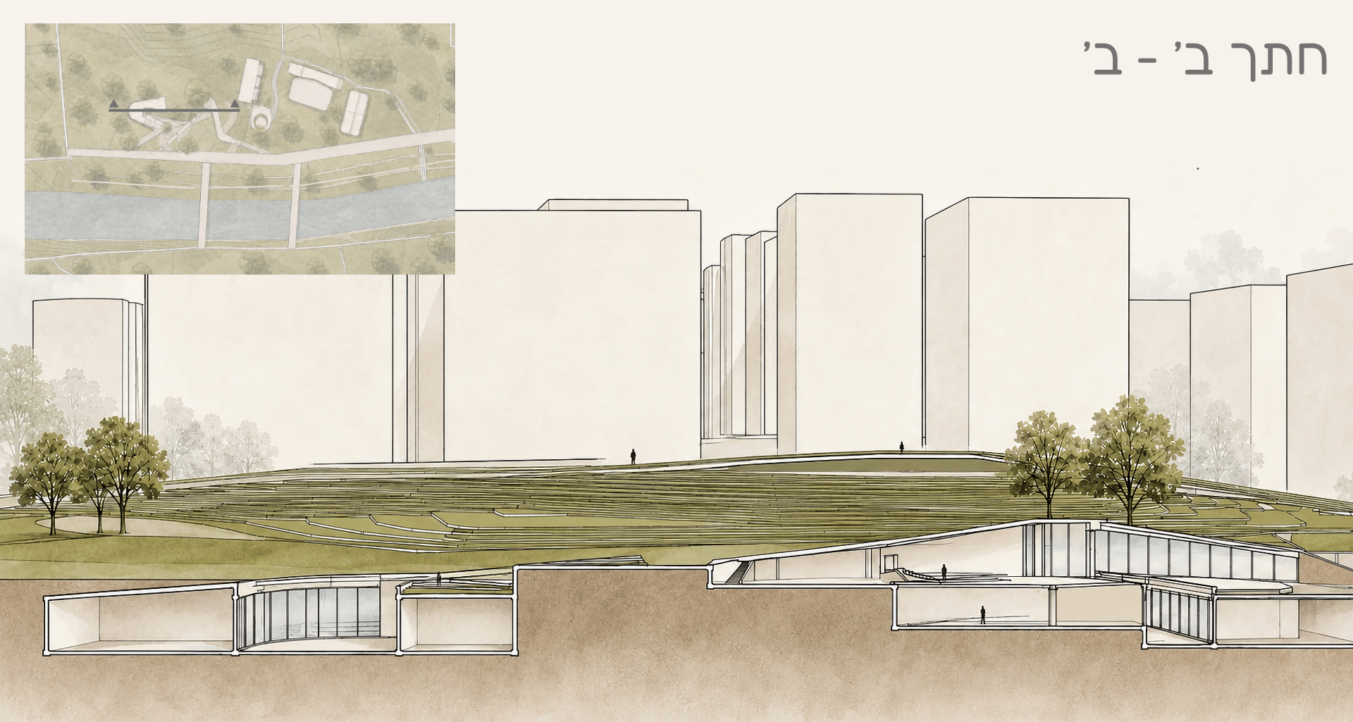
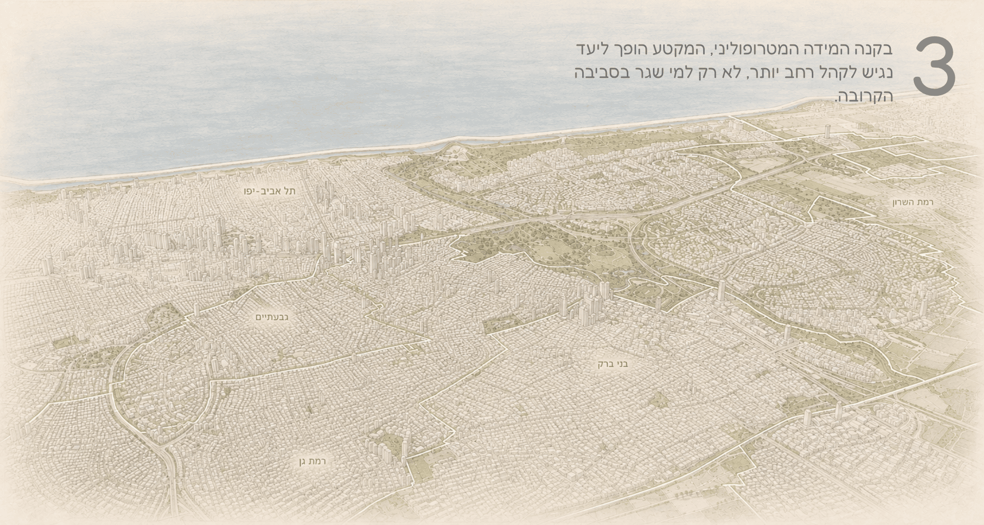
המהלך התכנוני מבקש לשזור מחדש את העיר, הדרך, הפארק והנחל למערכת אחת רציפה. שדרות רוקח משוקעות מתחת למפלס הפארק, והמרחב הירוק ממשיך מעליהן ישירות מכוכב הצפון. המבנים נטמעים בתוך הטופוגרפיה באמצעות בינוי שקוע, גגות הממשיכים את פני הפארק, חצרות שקועות וחזיתות מזוגגות, כך שהקרקע, האדריכלות והתנועה פועלות כמערכת אחת.
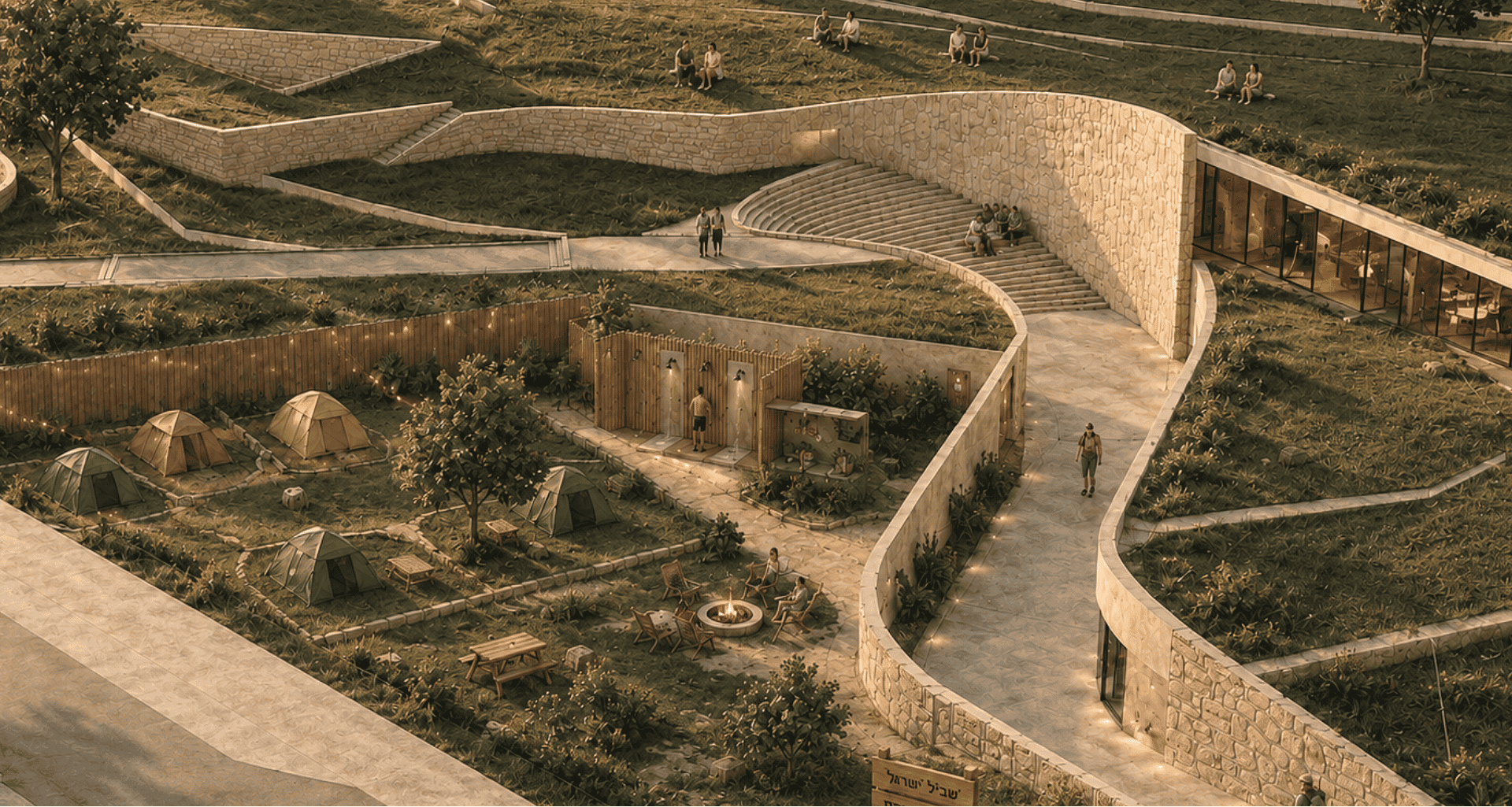
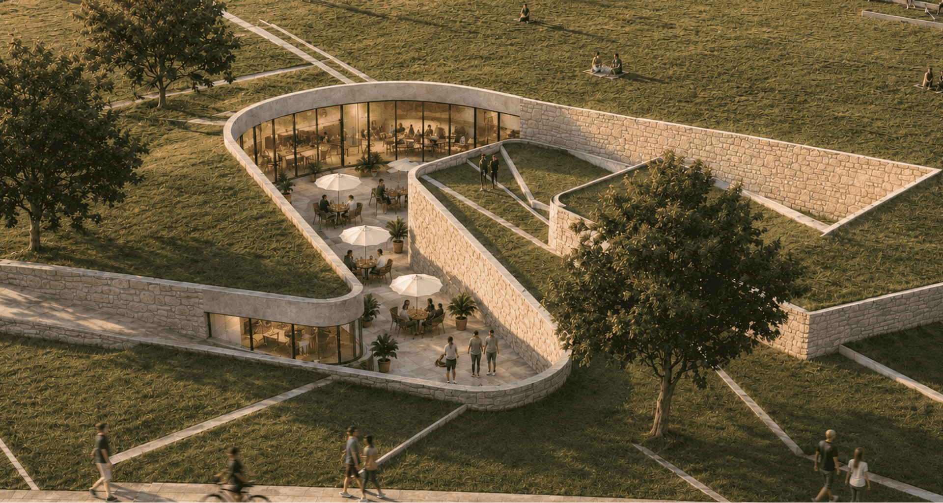
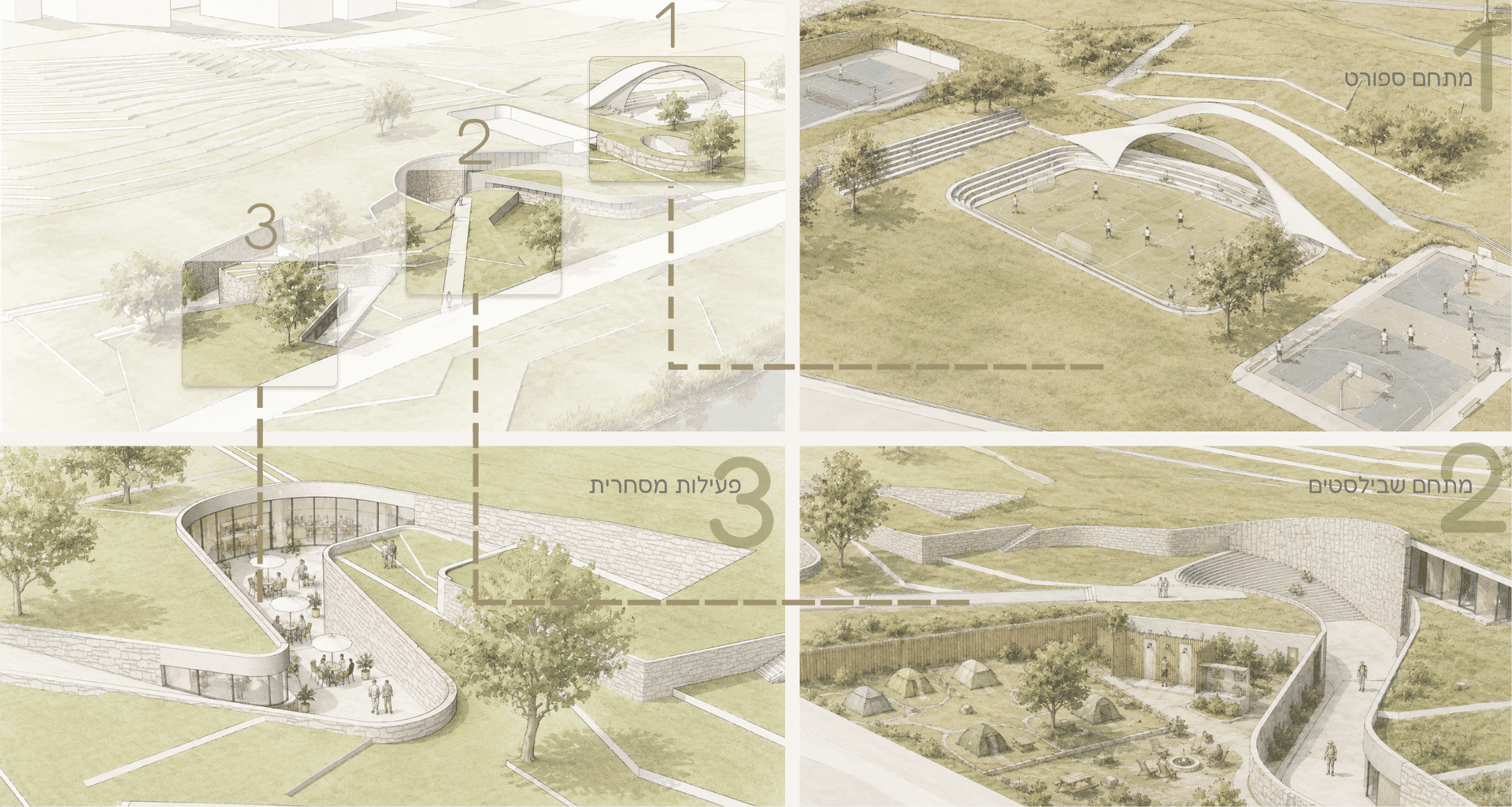
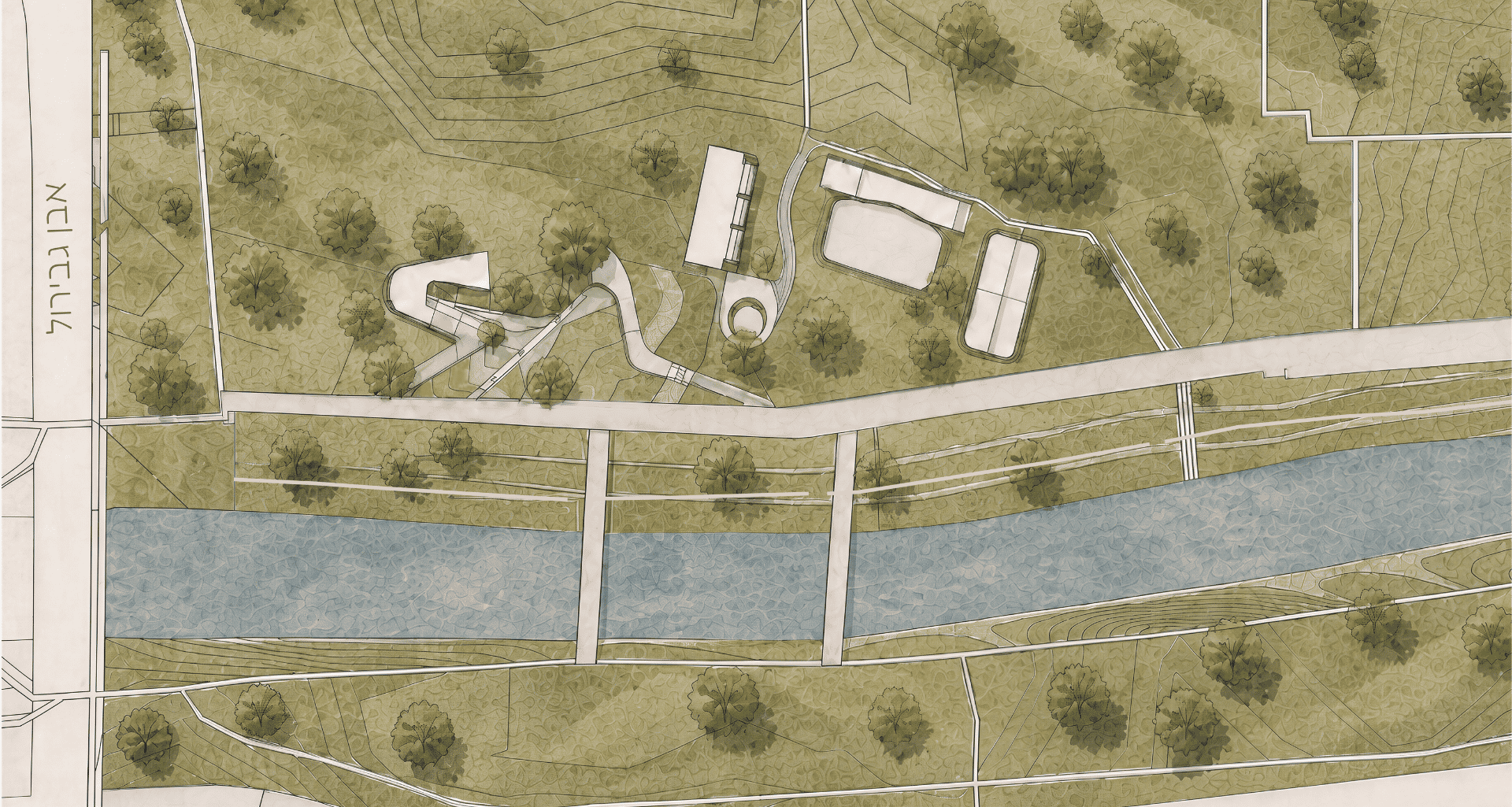
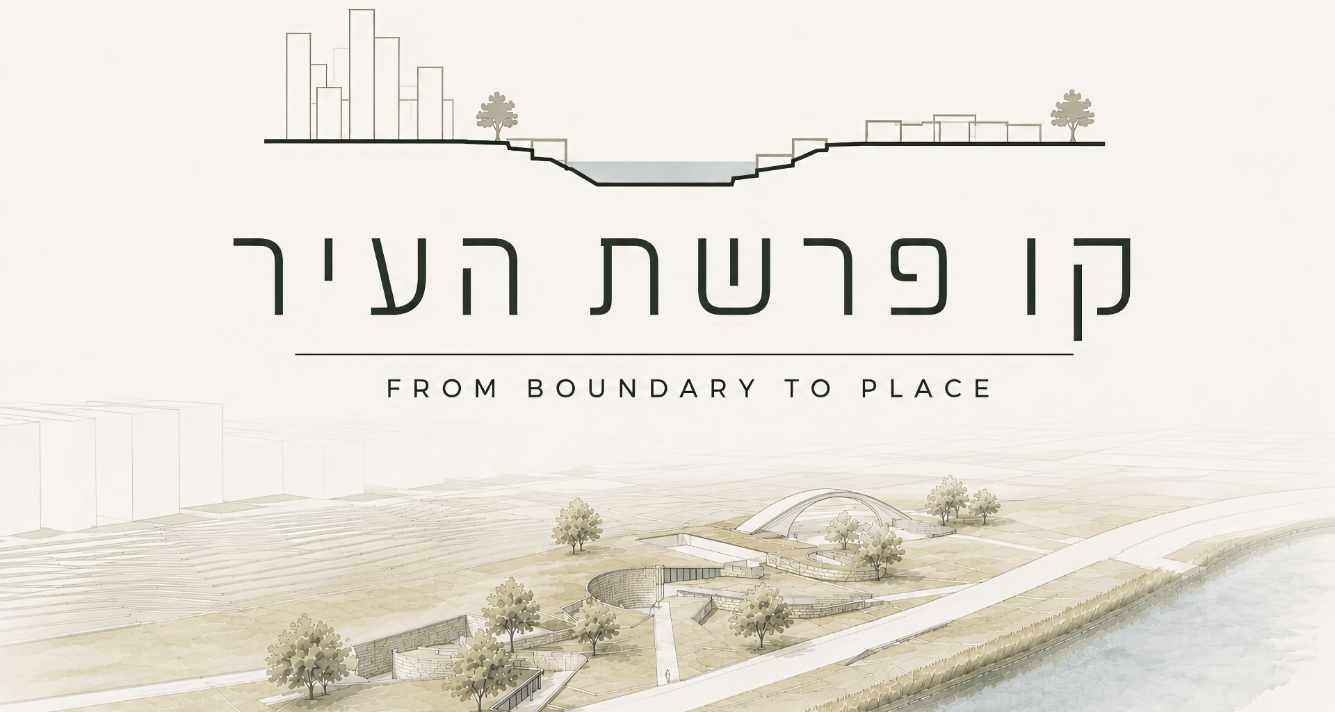
לאורך הרצף משולבים שלושה מוקדי פעילות: מתחם ספורט הממשיך את פעילות הספורטק, מתחם שביליסטים על תוואי שביל ישראל הכולל מרחבי מנוחה, לינה קצרה, מקלחות והתארגנות, ומתחם בתי קפה המייצר מוקד יומיומי של מפגש ושהייה. המסלול ממשיך עד שפת הנחל, שם טרסות מדורגות מקרבות את המשתמש אל המים ושני גשרים חדשים מחברים בין שתי הגדות.
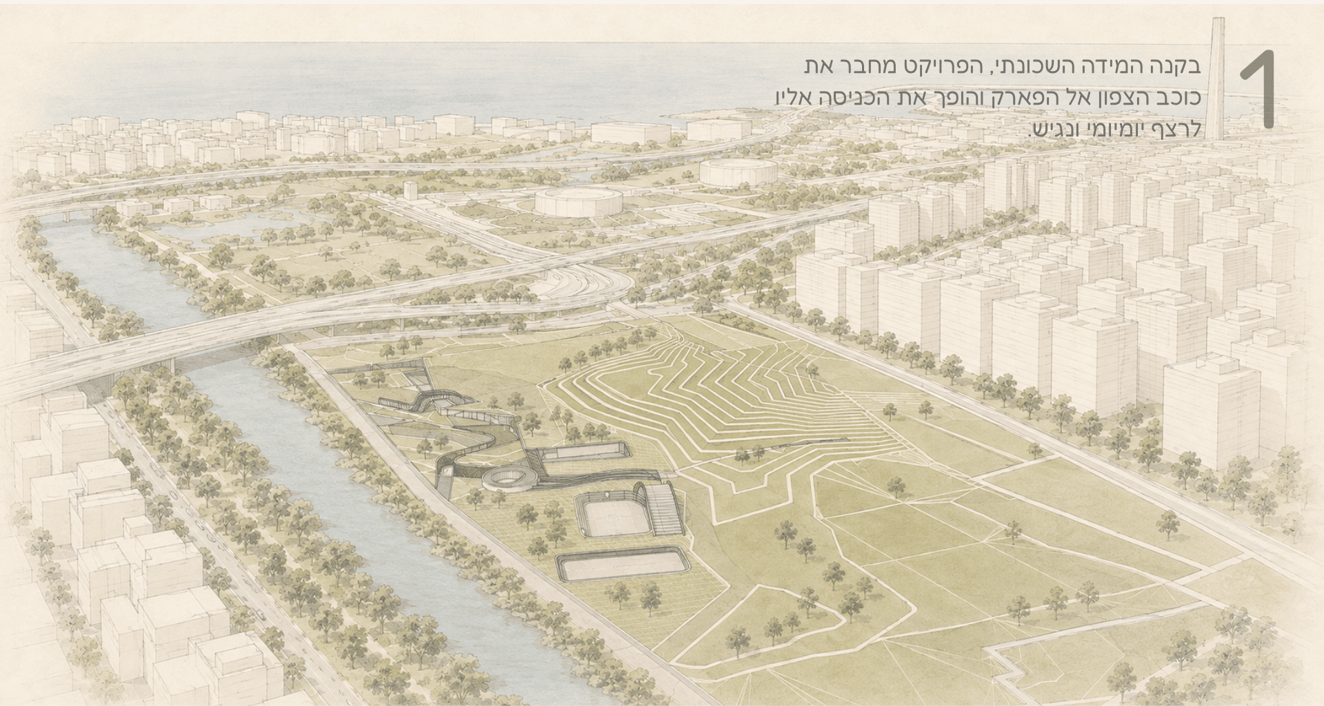
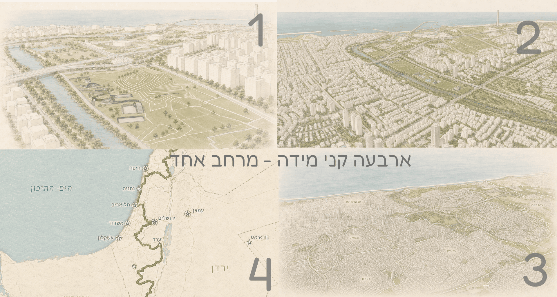
כך נפגשים בפרויקט ארבעה קני מידה – השכונתי, העירוני, המטרופוליני והארצי. "קו פרשת העיר" מבקש להפוך את הירקון מקו שמסמן היכן העיר נגמרת, למקום שמחבר בין שכונה, עיר, מטרופולין וארץ.
The project begins with the question of where the city ends in our perception. A study of mental maps of Tel Aviv revealed that although the city is perceived as a connected and intensive urban system, it is also experienced as a space divided by boundaries. One of the boundaries that repeatedly appeared in the maps was the Yarkon River – a significant open space at the heart of the city that is often reduced, in perception, to a line marking the end of the familiar city and the beginning of another territory.
The Yarkon is a continuous system that crosses the metropolitan area and reaches the sea, yet within Tel Aviv it often functions as a dividing line. The connection between the city, the park, and the river is fragmented, and the area is not experienced as a continuous urban sequence. As the city continues to expand northward with the development of the new Sde Dov district, an opportunity emerges to rethink the Yarkon – not as an urban edge, but as a central connecting space.
The project focuses on the Sportek section and the northern bank of the Yarkon, where the gap between the site's potential and its current condition is particularly evident. Rokach Boulevard, the large distance to the river, and the exposed character of the park create a disconnect between the urban fabric, the park, and the water. This leads to the project's central question: How can access to the river become not merely a route of passage, but an urban space in itself?
The design strategy seeks to weave the city, road, park, and river back together into one continuous system. Rokach Boulevard is lowered beneath the level of the park, allowing the green landscape to extend directly from Kochav HaTzafon across it. The buildings are embedded into the topography through sunken architecture, roofs that continue the surface of the park, sunken courtyards, and glazed facades, allowing ground, architecture, and movement to operate as a single system.
Along this sequence, three activity hubs are integrated: a sports complex that extends the existing Sportek activities, an Israel Trail hikers' complex along the route of the Israel National Trail, including spaces for rest, short-term accommodation, showers, and preparation, and a cafe complex that creates an everyday setting for meeting and lingering. The route continues toward the riverbank, where stepped terraces bring visitors gradually closer to the water, while two new bridges connect the two banks.
The project thus brings together four scales – neighborhood, city, metropolis, and nation. "From Boundary to Place" seeks to transform the Yarkon from a line marking where the city ends into a place that connects neighborhood, city, metropolis, and country.
ينطلق المشروع من سؤال: أين تنتهي المدينة في وعينا؟ أظهر بحث قائم على الخرائط الذهنية لتل أبيب أنه، رغم إدراك المدينة بوصفها منظومة حضرية مترابطة ومكثفة، فإنها تُعاش أيضًا كحيز تقسمه حدود مختلفة. وكان نهر اليركون أحد الحدود التي تكررت في هذه الخرائط – وهو فضاء مفتوح ومهم في قلب المدينة، لكنه يُختزل أحيانًا في الوعي إلى خط يحدد نهاية المدينة المألوفة وبداية حيز آخر.
يشكل اليركون منظومة متصلة تعبر المنطقة الحضرية الكبرى وتصل إلى البحر، إلا أنه داخل تل أبيب يعمل في مواقع عديدة كخط فاصل. فالعلاقة بين المدينة والحديقة والنهر مجزأة، ولذلك لا يُختبر المكان بوصفه تسلسلًا حضريًا متواصلًا. ومع استمرار توسع المدينة شمالًا وتطوير الحي الجديد في سدي دوف، تنشأ إمكانية لإعادة النظر في اليركون – ليس كحافة حضرية، بل كحيز مركزي رابط.
يركز المشروع على مقطع السبورتك والضفة الشمالية لنهر اليركون، حيث تظهر بوضوح الفجوة بين إمكانات الموقع وطريقة عمله اليوم. يشكل شارع روكاح، والمسافة الكبيرة حتى النهر، والطابع المكشوف للحديقة عوامل تخلق انفصالًا بين النسيج الحضري والحديقة والمياه. ومن هنا ينبثق السؤال المركزي للمشروع: كيف يمكن ألا يكون الوصول إلى النهر مجرد مسار عبور، بل أن يتحول الطريق إليه إلى حيز حضري بحد ذاته؟
يسعى التدخل التخطيطي إلى إعادة نسج المدينة والطريق والحديقة والنهر ضمن منظومة واحدة متصلة. يتم خفض شارع روكاح إلى ما دون مستوى الحديقة، بحيث يستمر الفضاء الأخضر فوقه مباشرة من حي كوخاف هتسافون. كما تندمج المباني داخل التضاريس من خلال بناء غائر، وأسقف تستمر كسطح للحديقة، وساحات غائرة وواجهات زجاجية، بحيث تعمل الأرض والعمارة والحركة كنظام واحد.
على امتداد هذا التسلسل تندمج ثلاثة مراكز للنشاط: مجمع رياضي يواصل أنشطة السبورتك القائمة، ومجمع لمتجولي درب إسرائيل يقع على مسار الدرب ويشمل أماكن للراحة، والمبيت القصير، والاستحمام والاستعداد، ومجمع للمقاهي يوفر مساحة يومية للقاء والمكوث. يستمر المسار حتى ضفة النهر، حيث تقرب المدرجات المتدرجة المستخدم تدريجيًا من المياه، بينما يربط جسران جديدان بين الضفتين.
وهكذا يجمع المشروع بين أربعة مقاييس – الحي، والمدينة، والمتروبولين، والدولة. يسعى مشروع "من الحد إلى المكان" إلى تحويل اليركون من خط يحدد أين تنتهي المدينة، إلى مكان يربط بين الحي والمدينة والمتروبولين والدولة.