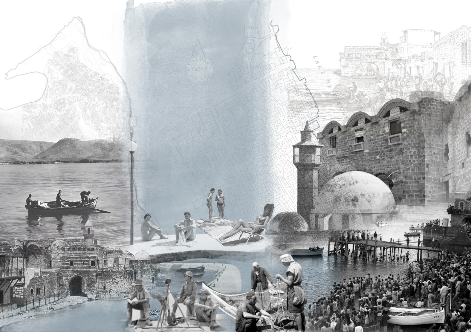
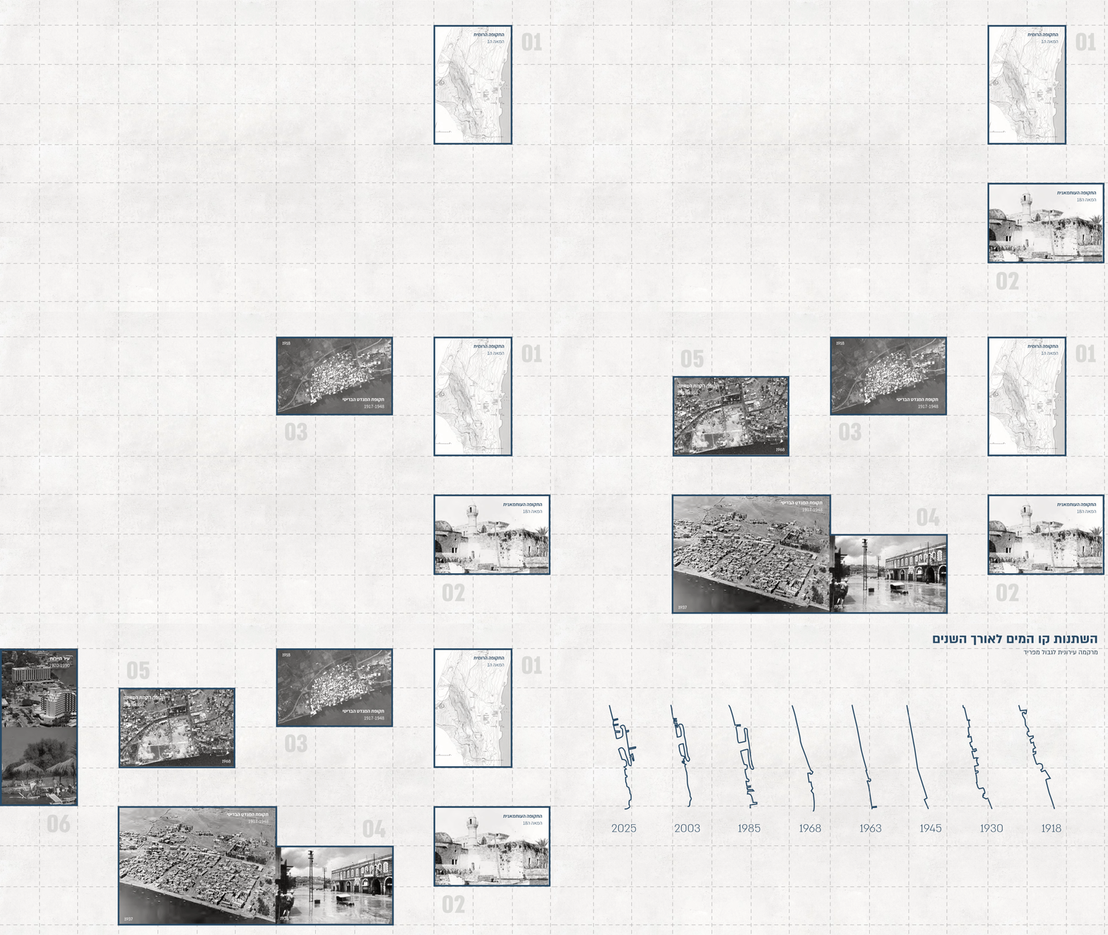
טבריה, עיר שקיומה והתפתחותה ההיסטורית שזורים בימת הכנרת, ניצבת כיום בפני פרדוקס מרחבי: המים המגדירים את נופה ואת זהותה הפכו לקצה מנותק מן המרקם העירוני. תהליכים היסטוריים, שינויי מפלס המים, הרס המרקם העתיק ופיתוח תיירותי הובילו להיחלשות הקשר בין העיר לכנרת, ויצרו קו חוף מקוטע שאינו מתפקד כחלק בלתי נפרד מן המרחב העירוני.
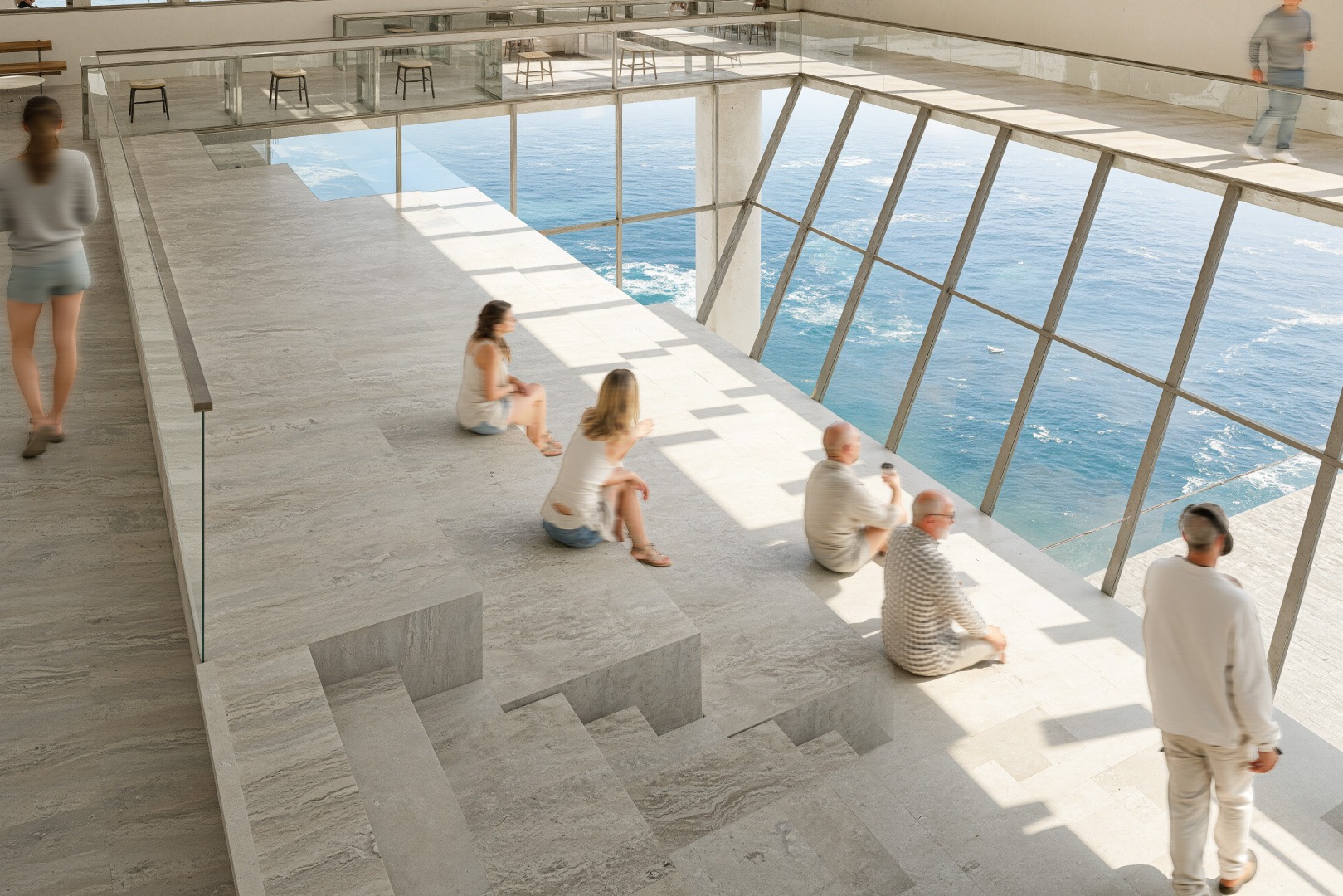
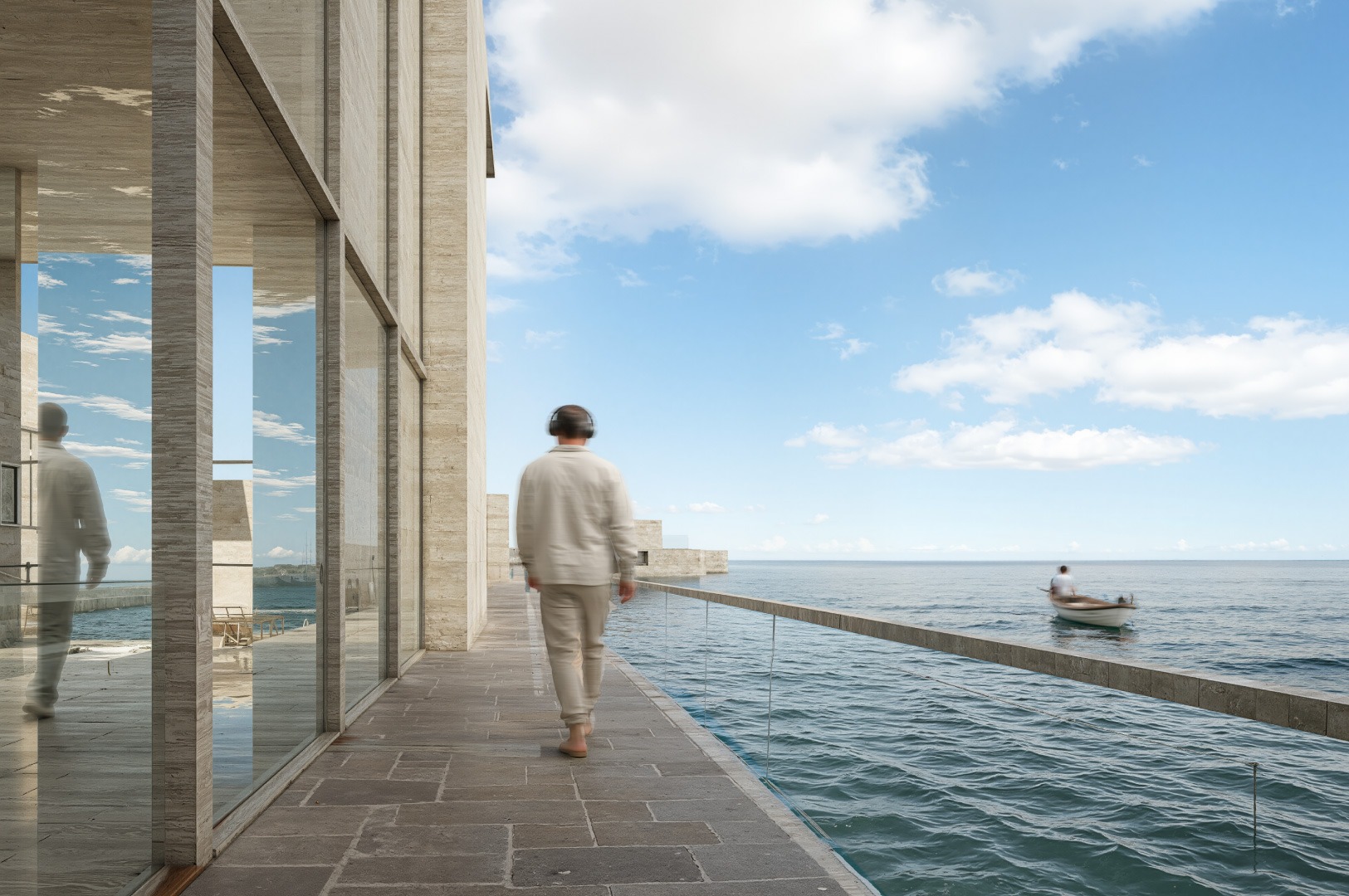
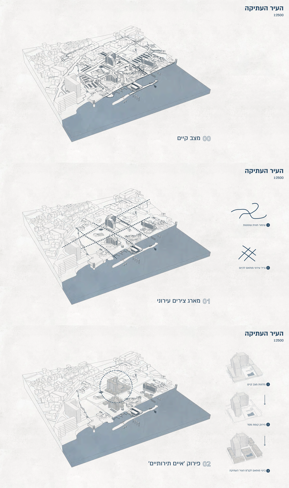
מתוך מציאות זו, הפרויקט שואל כיצד ניתן להגדיר מחדש את קו המים, כך שיהפוך מקצה עירוני מנותק למרחב ציבורי פעיל, המייצר המשכיות בין העיר לכנרת. ההתערבות מתמקדת בעיר העתיקה של טבריה- מרחב בעל ערך היסטורי, תרבותי ונופי יוצא דופן, שכיום מאופיין בשטחים ריקים, מבנים נטושים ומובלעות תיירותיות (מלונות) המחלישות את הרצף העירוני. התכנון מבקש להשיב למקום את איכויותיו ההיסטוריות דרך פרשנות עכשווית לעקרונות המרחביים שאפיינו אותו בעבר.
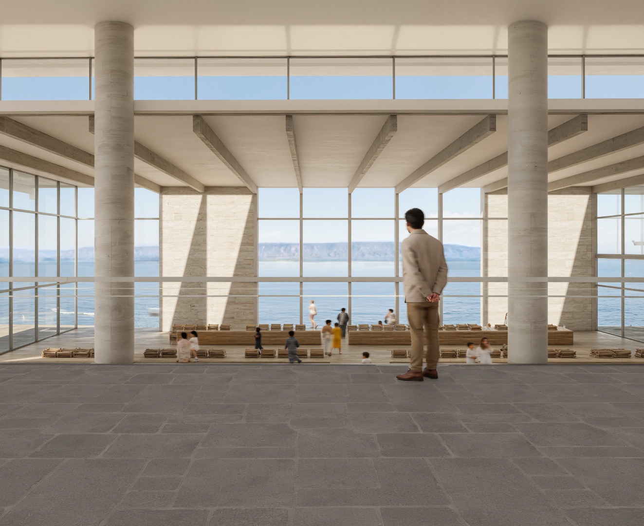
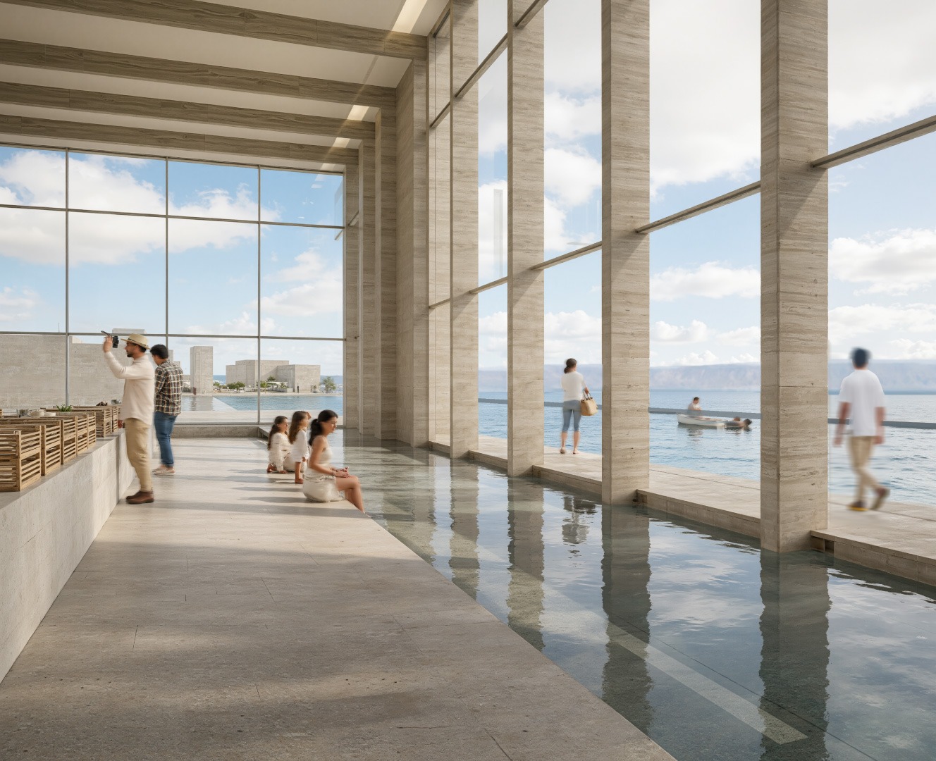
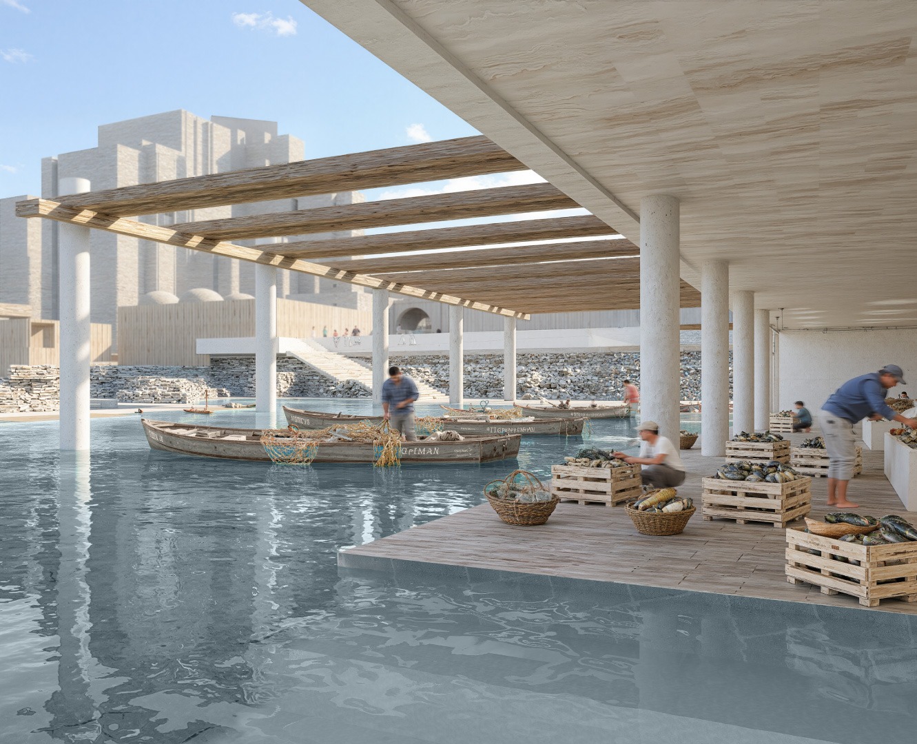
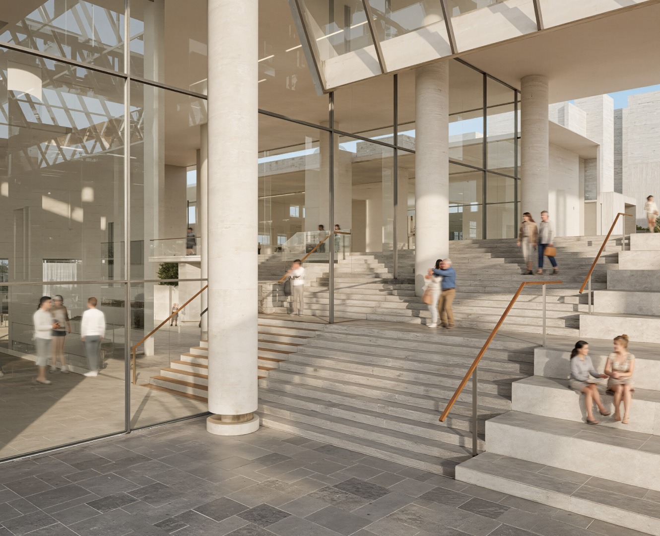
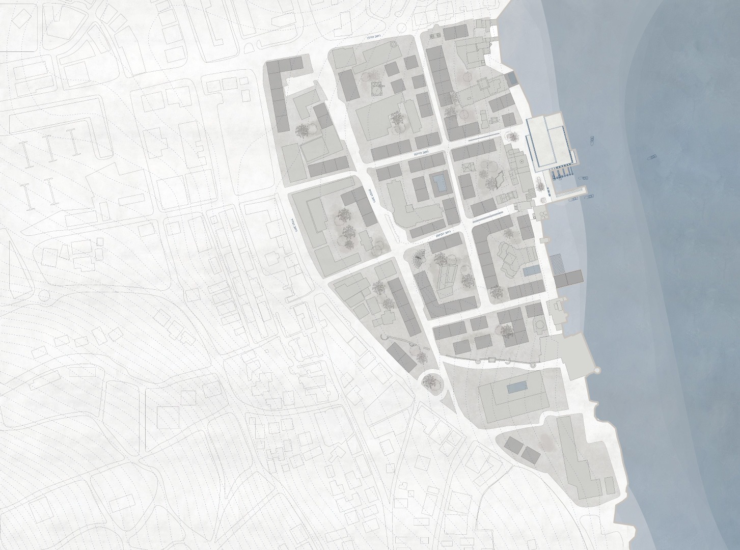
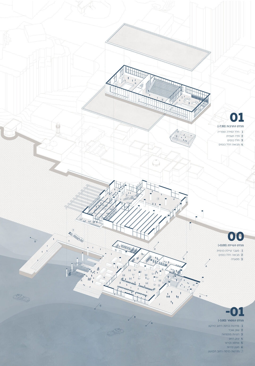
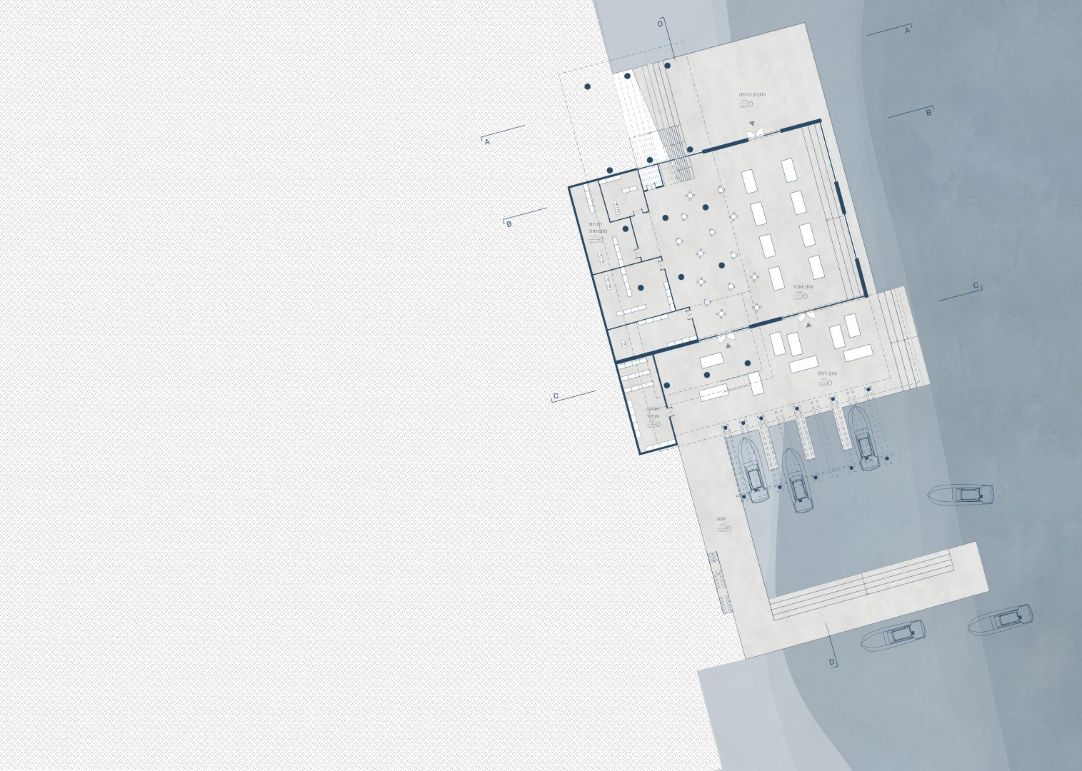
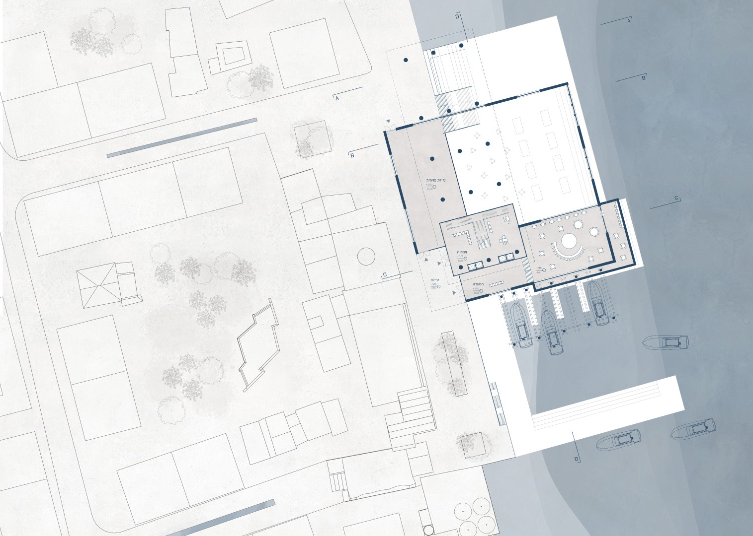
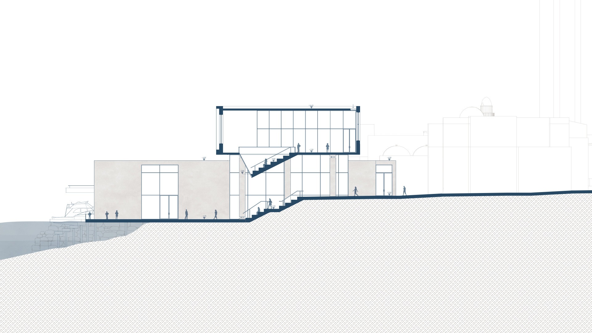
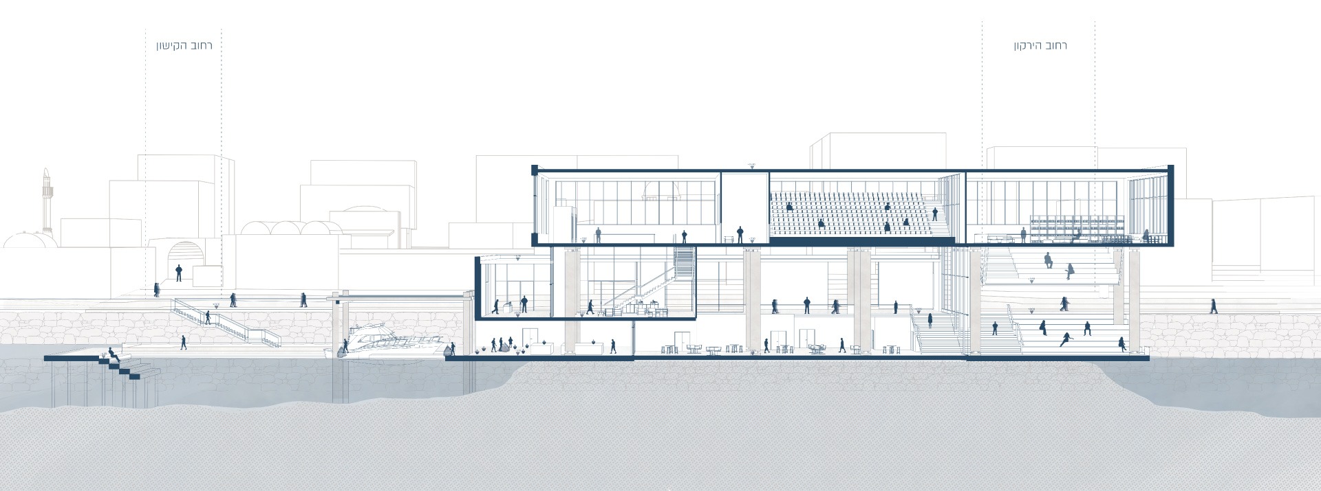
ההצעה התכנונית מתגבשת בשלושה קני מידה משלימים: בקנה המידה המתחמי, ארגון מחדש של המרקם הבנוי ויצירת מארג רחובות ומרחבים ציבוריים המחברים בין העיר העתיקה לכנרת. בקנה המידה הצירי, חיזוק רציפות התנועה וההליכה באמצעות בינוי מעורב שימושים, המשלב מגורים, מסחר, תיירות ומורשת ומעודד פעילות עירונית מגוונת לאורך שעות היום. בקנה המידה המבני, תכנון מבנה ציבורי על שפת הכנרת המשלב שוק דגים ואוכל מקומי, תרבות, למידה ופנאי, תוך יצירת רצף בין הרחוב, הטיילת והמים.
הפרויקט מבקש לשנות את תפיסת קו המים מגבול המפריד בין העיר לכנרת לסף עירוני המאפשר מפגש, תנועה וחיים משותפים. בכך הוא מציע עתיד שבו הכנרת אינה רק נוף הנשקף מן העיר או מוקד משיכה תיירותי, אלא חלק בלתי נפרד מזהותה ומחיי היומיום של טבריה.
Tiberias, a city whose existence and historical development are deeply intertwined with the Sea of Galilee, now faces a spatial paradox: the lake that define its landscape and identity have become an edge disconnected from the urban fabric. Historical transformations, fluctuations in water levels, the destruction of the historic urban fabric, and tourism-oriented development have weakened the relationship between the city and the lake, creating a fragmented waterfront that no longer functions as an integral part of the urban environment.
In response to this condition, the project asks how the waterfront can be redefined, transforming it from a disconnected urban edge into an active public space that establishes continuity between the city and the water. The intervention focuses on the Old City of Tiberias, an area of exceptional historical, cultural, and landscape significance, currently characterized by vacant spaces, abandoned buildings, and isolated tourist enclaves (hotels) that disrupt urban continuity. The design seeks to restore the area's historical spatial qualities through a contemporary reinterpretation of the principles that once shaped its urban fabric.
The proposal unfolds across three complementary scales. At the district scale, it reorganizes the built fabric and establishes a network of streets and public spaces connecting the Old City to the Sea of Galilee. At the street scale, it strengthens pedestrian connectivity and spatial continuity through mixed-use development, integrating housing, commerce, tourism, and heritage to encourage diverse urban activities throughout the day. At the building scale, it introduces a public building along the waterfront, combining a fish market and local food market with cultural and educational spaces, while establishing continuity between the street, the promenade, and the water.
The project seeks to redefine the waterfront from a boundary separating the city from the Sea of Galilee into an urban threshold that enables encounters, movement, and shared urban life. In doing so, it envisions a future in which the lake is no longer merely a landscape viewed from the city or a tourist destination, but an integral part of Tiberias' identity and everyday life.