שדרות הגעתון הן הציר המרכזי של נהריה, אך הנחל שסביבו נבנתה העיר הפך עם השנים לתעלה מנותקת מהמרחב העירוני. המים עוברים בלב העיר, אך כמעט שאינם חלק מחיי היומיום שלה.
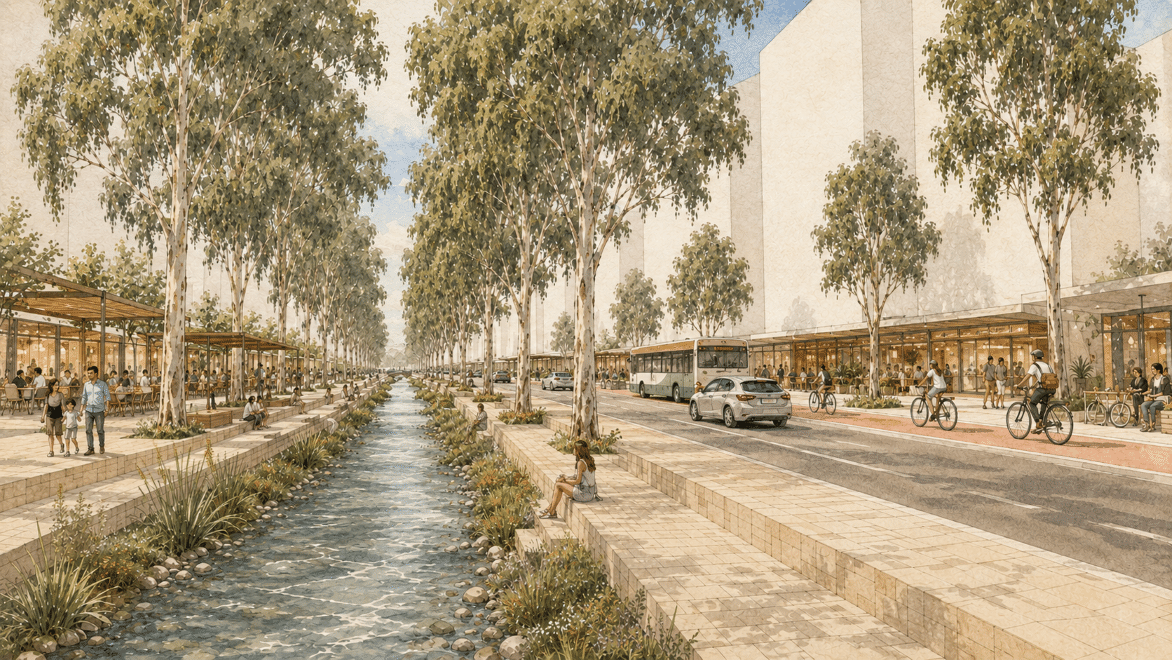
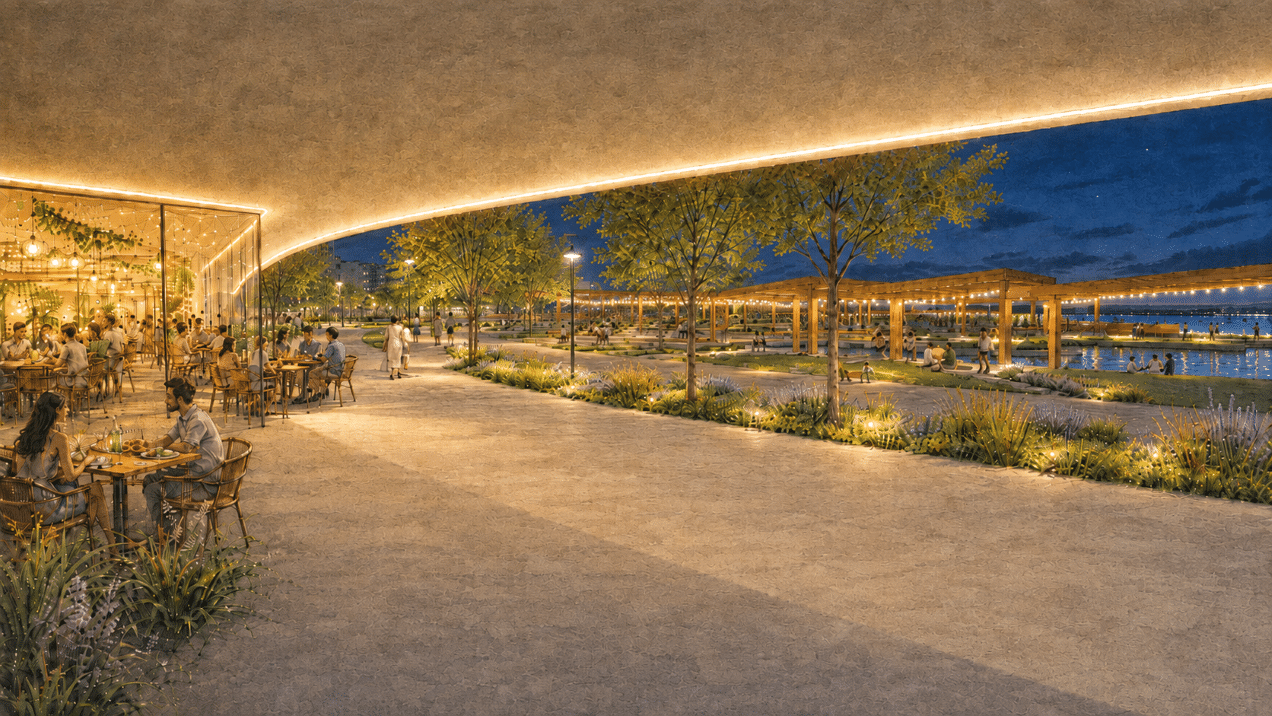
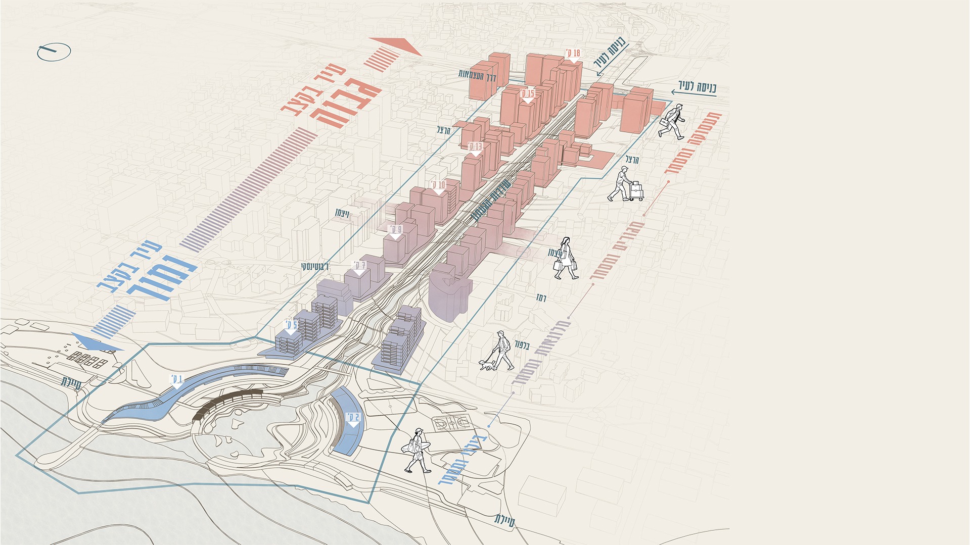
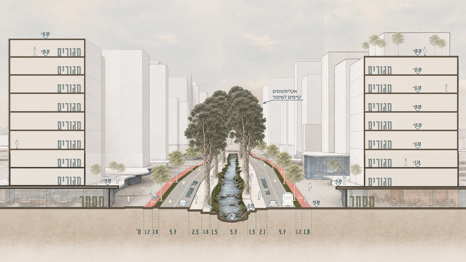
הפרויקט מציע לקרוא מחדש את ציר הגעתון כמערכת עירונית ונופית אחת – מתחנת הרכבת, דרך מרכז העיר ועד למפגש עם הים. לאורך השדרה מתחזק הקשר אל הנחל באמצעות מרחבים ציבוריים פעילים, מסחר, תעסוקה, תנועה רכה, צמחיית נחל ומרחבים המותאמים למצבי המים המשתנים.
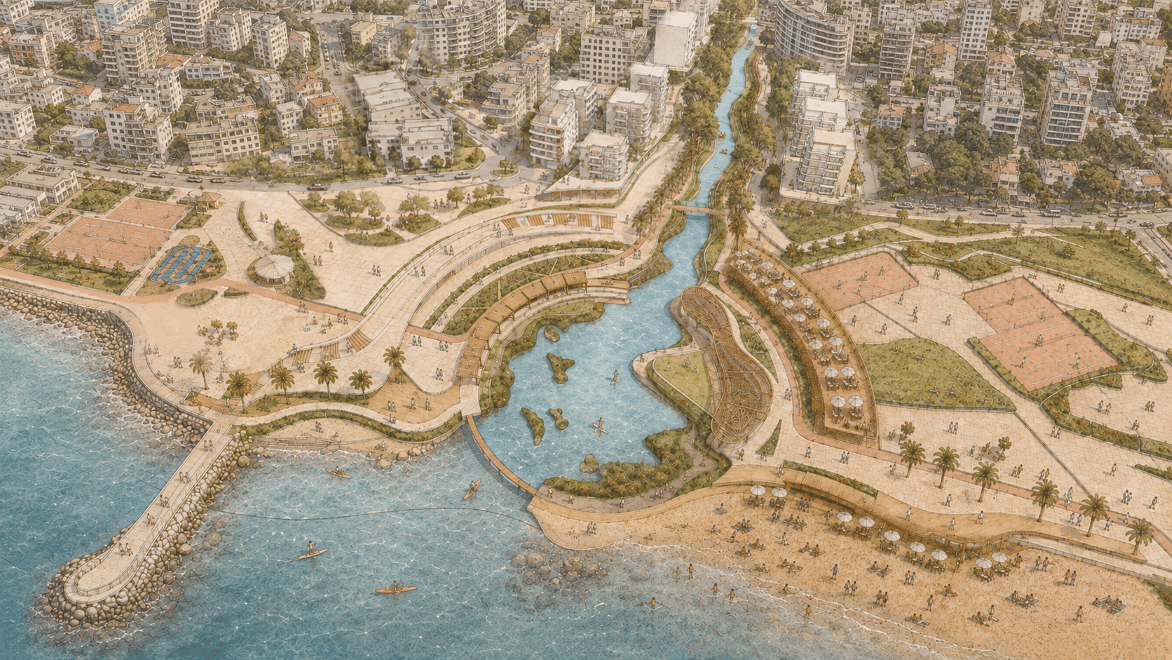
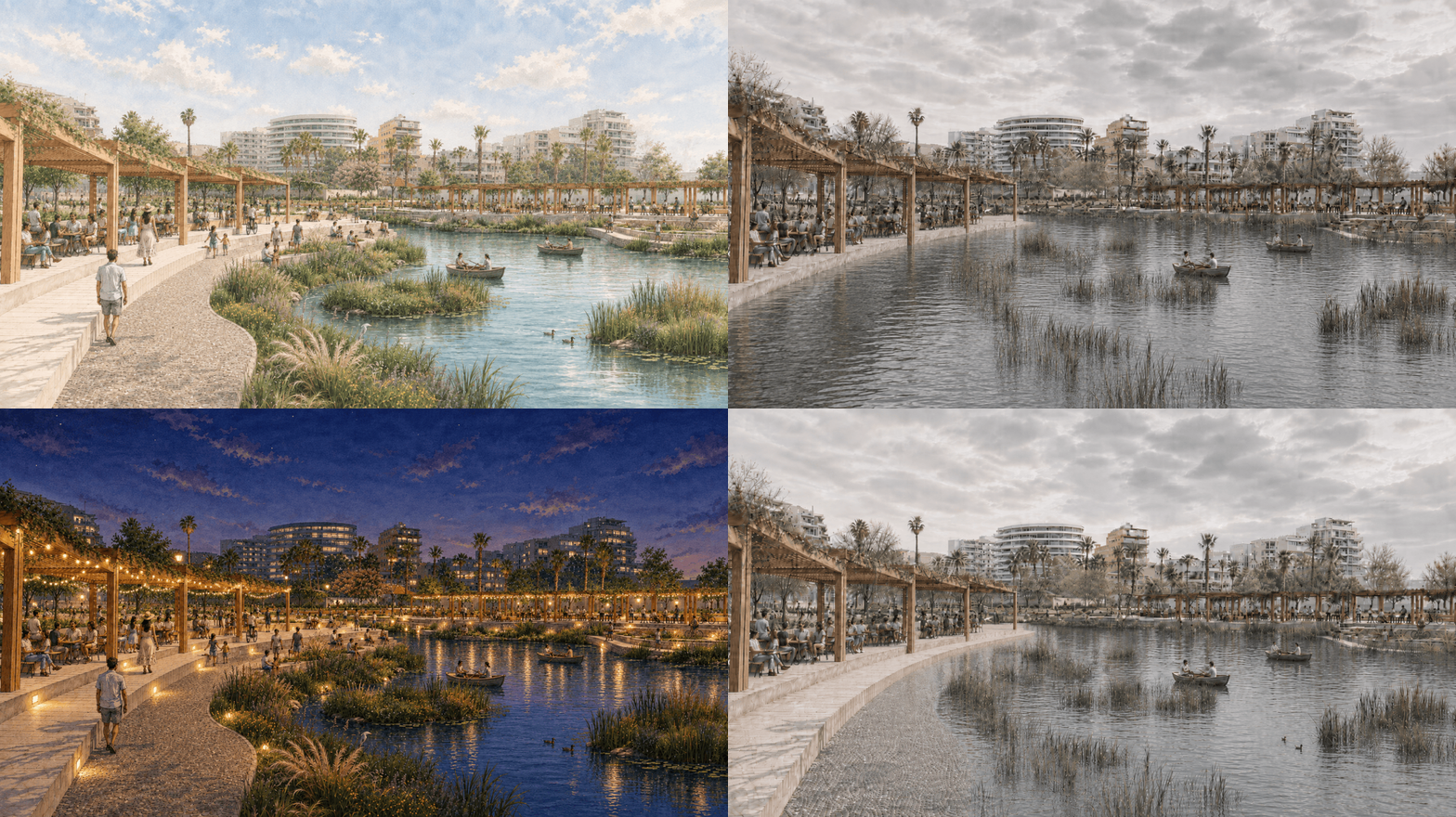
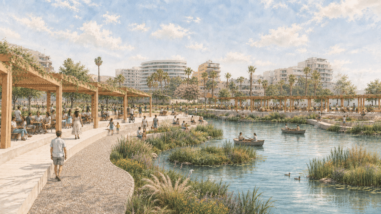
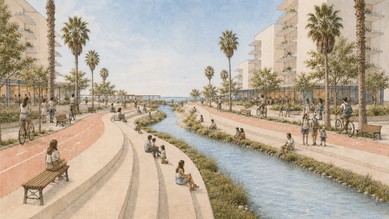
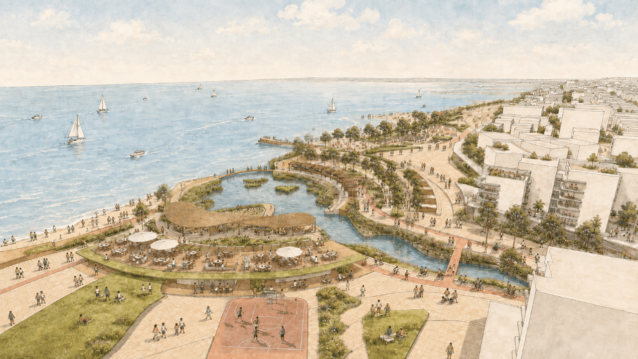
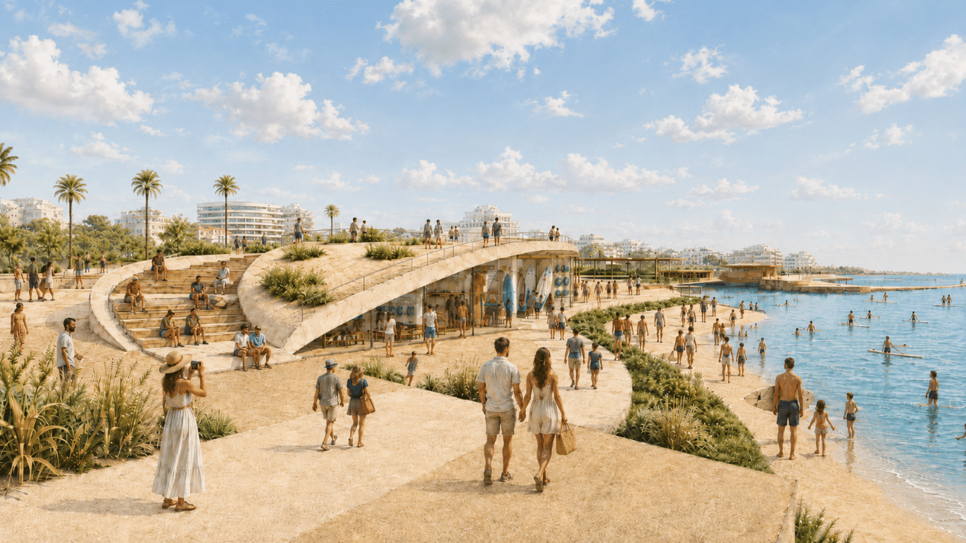
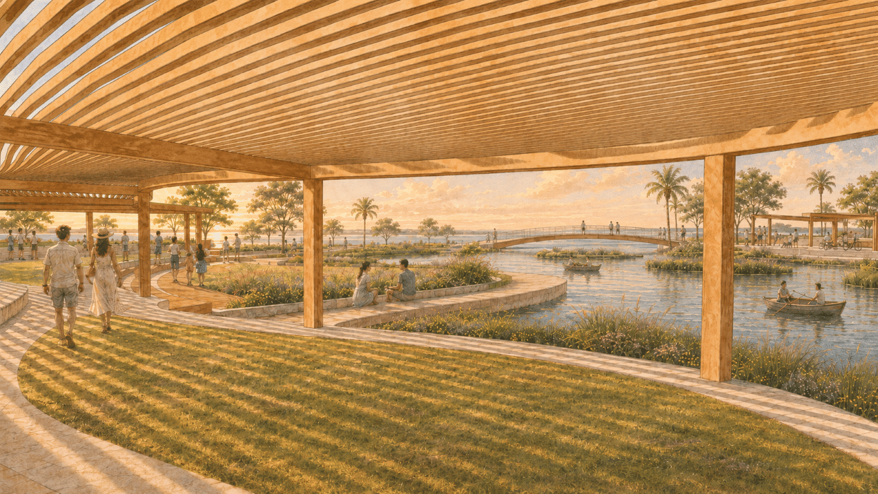
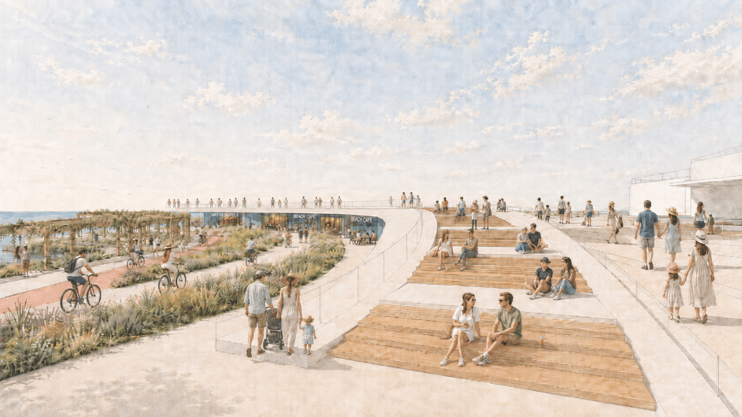
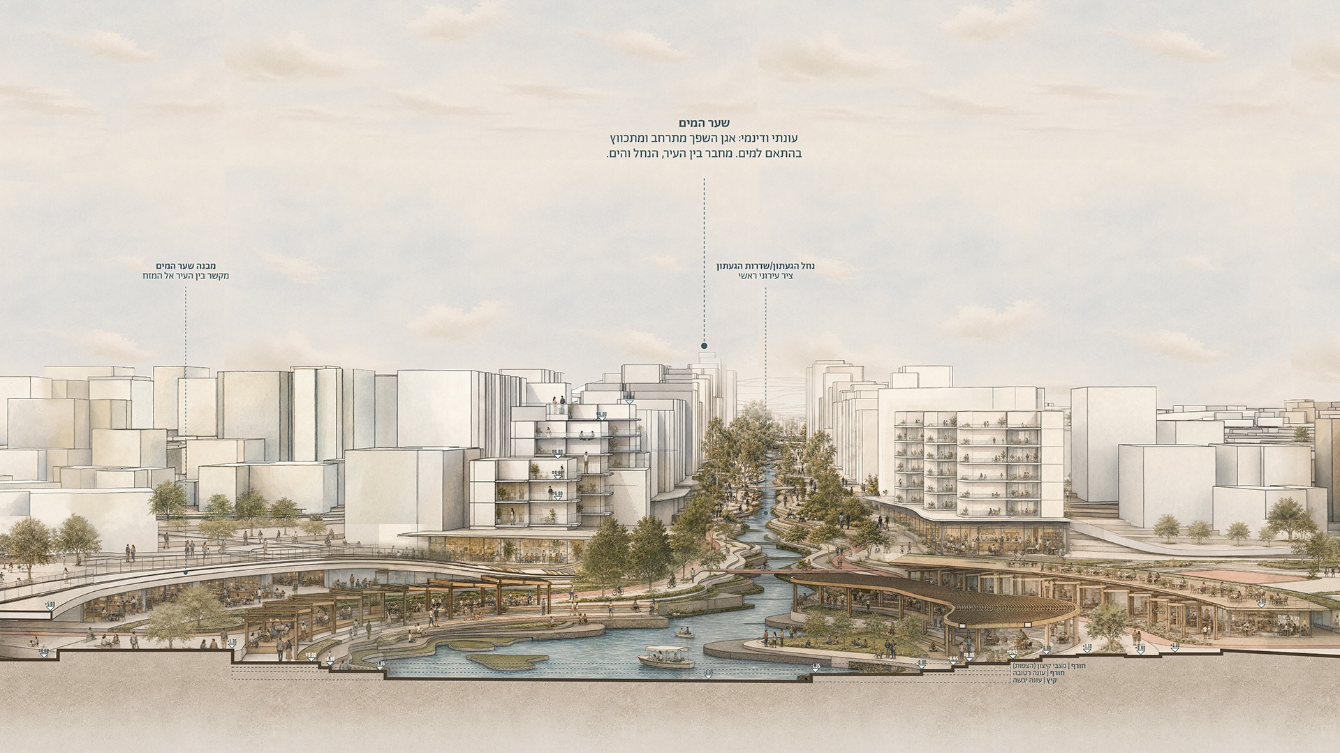
בשפך מתרחב הנחל והופך ל״שער מים״ עירוני: מרחב המחבר בין העיר, החוף והים, ומעניק לנהריה מוקד ציבורי חדש הנשען על זהות המקום. התכנון אינו מבקש לקבע את הנחל במצב אחד, אלא מאפשר לו להשתנות לאורך השנה. בעונות היבשות משמשות גדות הגעתון מרחב ציבורי פעיל ונגיש ובעונות הגשומות הן מאפשרות למים להתרחב באופן מבוקר. כך הופכים שינויי המפלס, הזרימה וההצפה מחסם עירוני לחלק גלוי ומשמעותי מחוויית המקום.
כך הגעתון אינו עוד תשתית חבויה בתוך העיר, אלא מרחב חי שמוביל אותה – בשגרה, בעונות השנה וגם בעת הצפה.
Gaaton Boulevard is Nahariya’s central axis, yet over the years the stream around which the city was built has become a channel disconnected from the urban fabric. Water flows through the heart of the city but is barely part of its everyday life.
The project proposes reimagining the Gaaton corridor as a single urban and landscape system – from the railway station, through the city center, to the point where it meets the sea. Along the boulevard, the connection to the stream is strengthened through active public spaces, commerce, employment, soft mobility, streamside vegetation, and spaces adapted to changing water conditions.
At its mouth, the stream widens and becomes an urban “Water Gate”: a space connecting the city, the shore, and the sea, and giving Nahariya a new public focal point rooted in the identity of the place. The design does not seek to confine the stream to a single state but allows it to change throughout the year. In the dry seasons, the banks of the Gaaton serve as active, accessible public space; in the rainy seasons, they allow the water to spread in a controlled way. In this way, changes in water levels, flow, and flooding become a visible and meaningful part of the experience of the place, rather than an urban barrier.
The Gaaton is no longer hidden infrastructure within the city, but a living space that shapes it – in everyday life, through the seasons, and during floods.
يشكّل شارع نهر هاغعتون المحور الرئيسي لمدينة نهاريا، إلا أن المجرى المائي الذي نشأت المدينة حوله تحوّل على مرّ السنين إلى قناة منفصلة عن النسيج الحضري. تمر المياه في قلب المدينة، لكنها تكاد لا تكون جزءًا من حياتها اليومية.
يقترح المشروع إعادة تصوّر محور نهر هاغعتون بوصفه منظومة حضرية ومشهدية واحدة، تمتد من محطة القطار، مرورًا بمركز المدينة، وصولًا إلى نقطة التقائه بالبحر. وعلى امتداد الشارع، تتعزز الصلة بالنهر من خلال مساحات عامة نشطة، وأنشطة تجارية وفرص عمل، ووسائل تنقّل لطيفة، ونباتات ضفاف النهر، ومساحات تتكيف مع تغيّر أحوال المياه.
عند مصبّه، يتسع النهر ويتحول إلى «بوابة مائية» حضرية: مساحة تصل المدينة بالشاطئ والبحر، وتمنح نهاريا مركزًا عامًا جديدًا متجذرًا في هوية المكان. لا يهدف التصميم إلى حصر النهر في حالة واحدة، بل يتيح له أن يتغير على مدار العام. ففي المواسم الجافة، تشكّل ضفاف نهر هاغعتون مساحة عامة نشطة ومتاحة للجميع، وفي المواسم الماطرة تتيح للمياه أن تمتد بطريقة منضبطة. وهكذا تصبح التغيرات في منسوب المياه وتدفقها والفيضانات جزءًا مرئيًا وذا أهمية من تجربة المكان، بدلًا من أن تشكّل عائقًا حضريًا.
لم يعد نهر هاغعتون بنية تحتية خفية داخل المدينة، بل أصبح مساحة حيوية تسهم في تشكيلها — في الحياة اليومية، وعلى مدار فصول السنة، وكذلك عند حدوث الفيضانات.