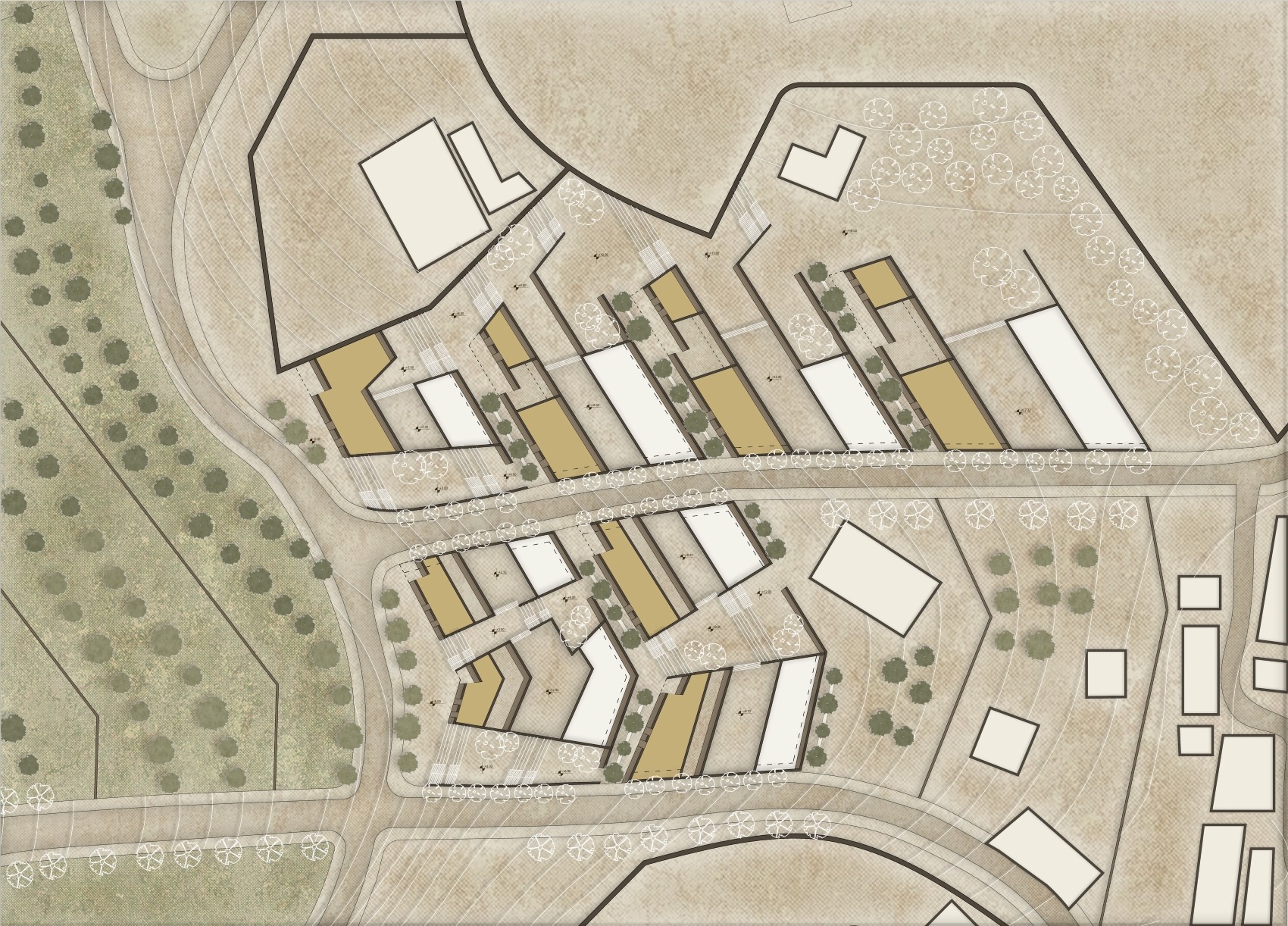
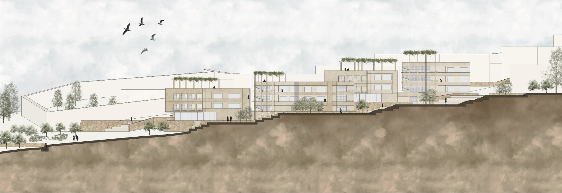
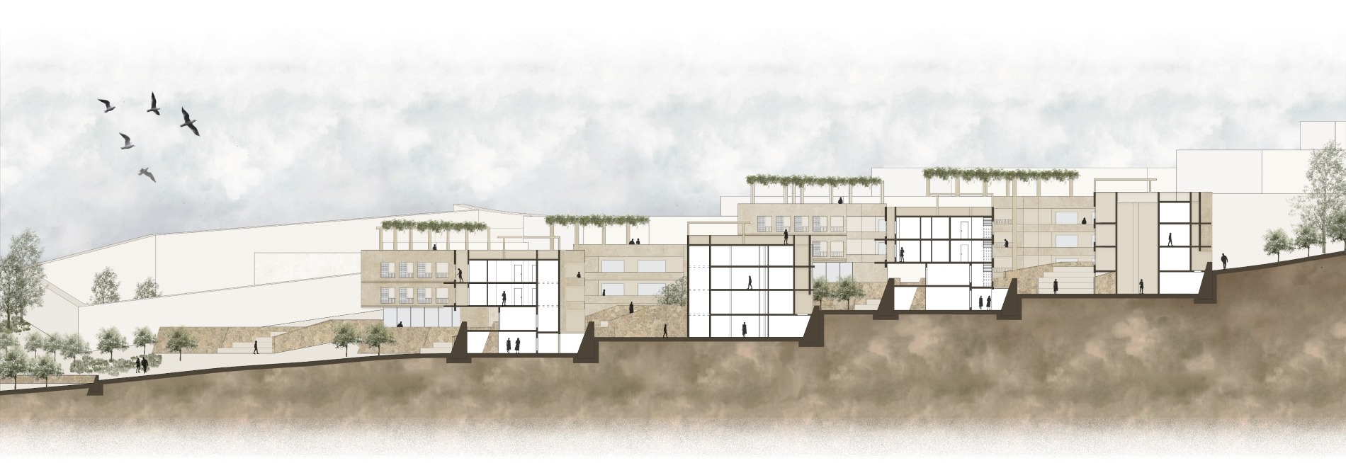
א־טור, השוכנת על מורדות הר הזיתים, מעוצבת על ידי המתח שבין הנוף ההיסטורי שלה לבין מגבלות התכנון העירוניות העכשוויות. במשך עשורים, רצועת הגרין בלט— מדיניות תכנון ששורשיה בתקופת המנדט הבריטי — הגבילה את התפתחות השכונה, תוך מתן עדיפות לשמירה על קו הרקיע של העיר העתיקה על פני צורכי הפיתוח של הקהילה המקומית. מצב זה הוביל להתפתחות פנימה, לצפיפות קיצונית, למחסור בדיור ולניתוק הולך וגובר מן המדרונות המערביים, שהיו חלק בלתי נפרד מזהותה של הכפר, וכתוצאה מכך לצמצום נוכחותה של השכונה על ההר.
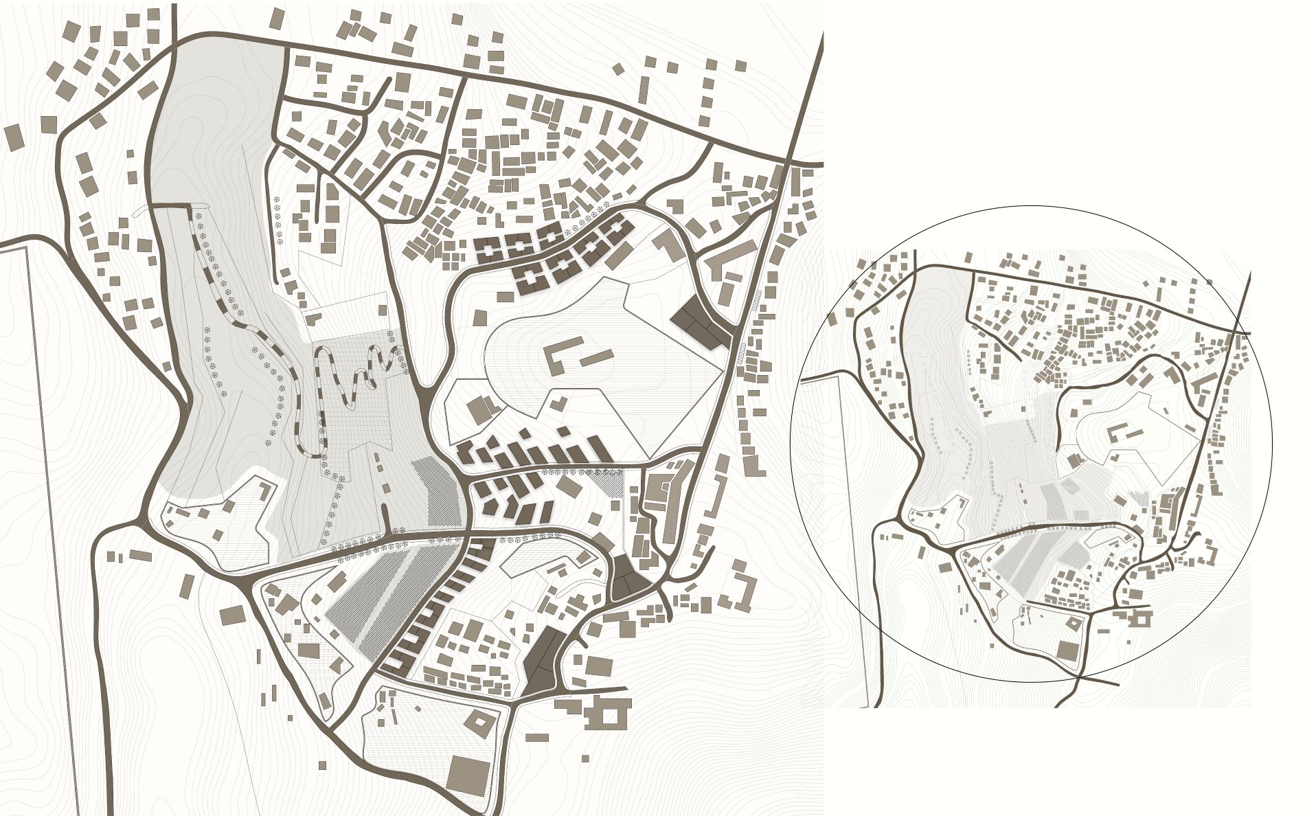
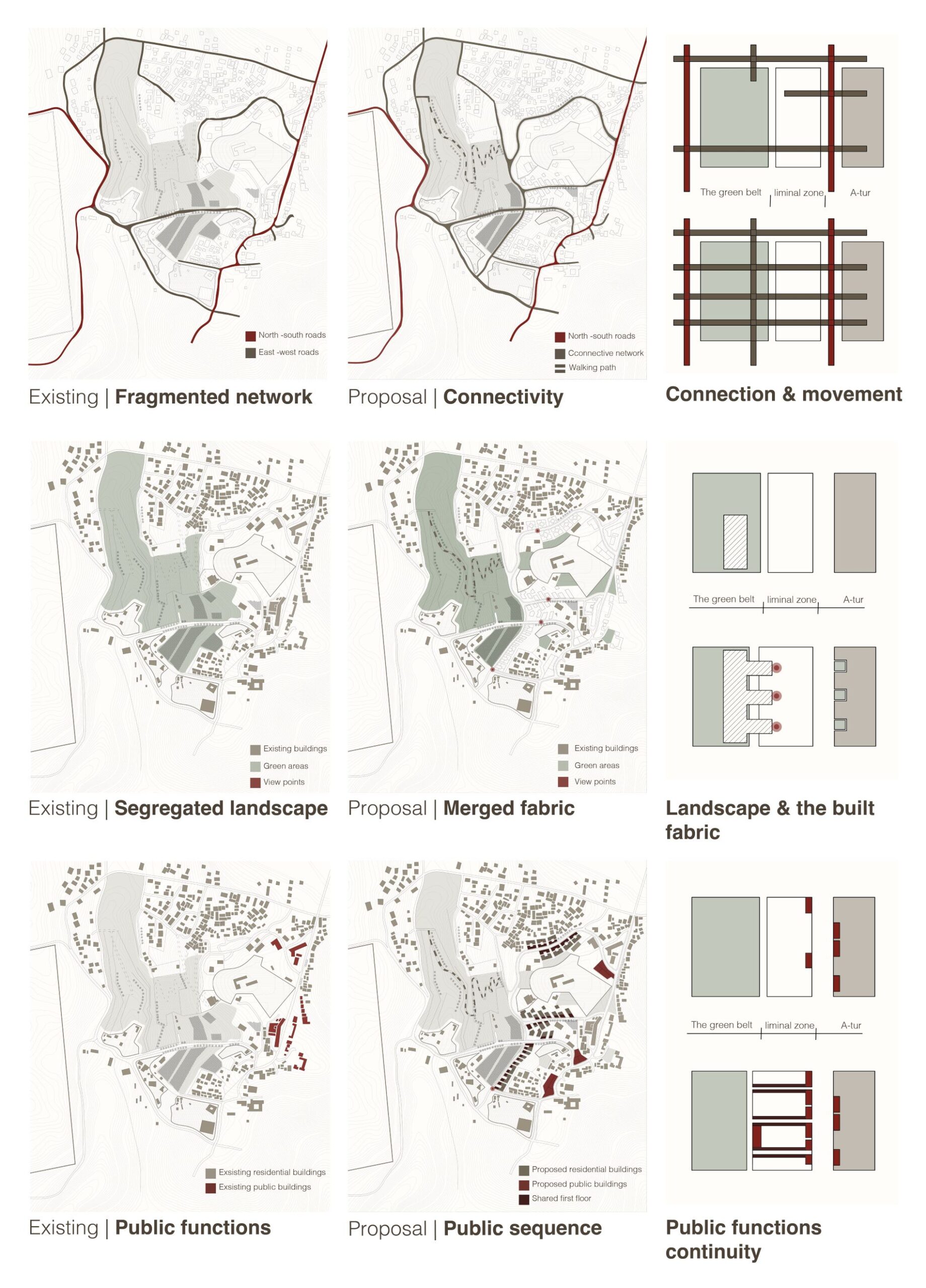
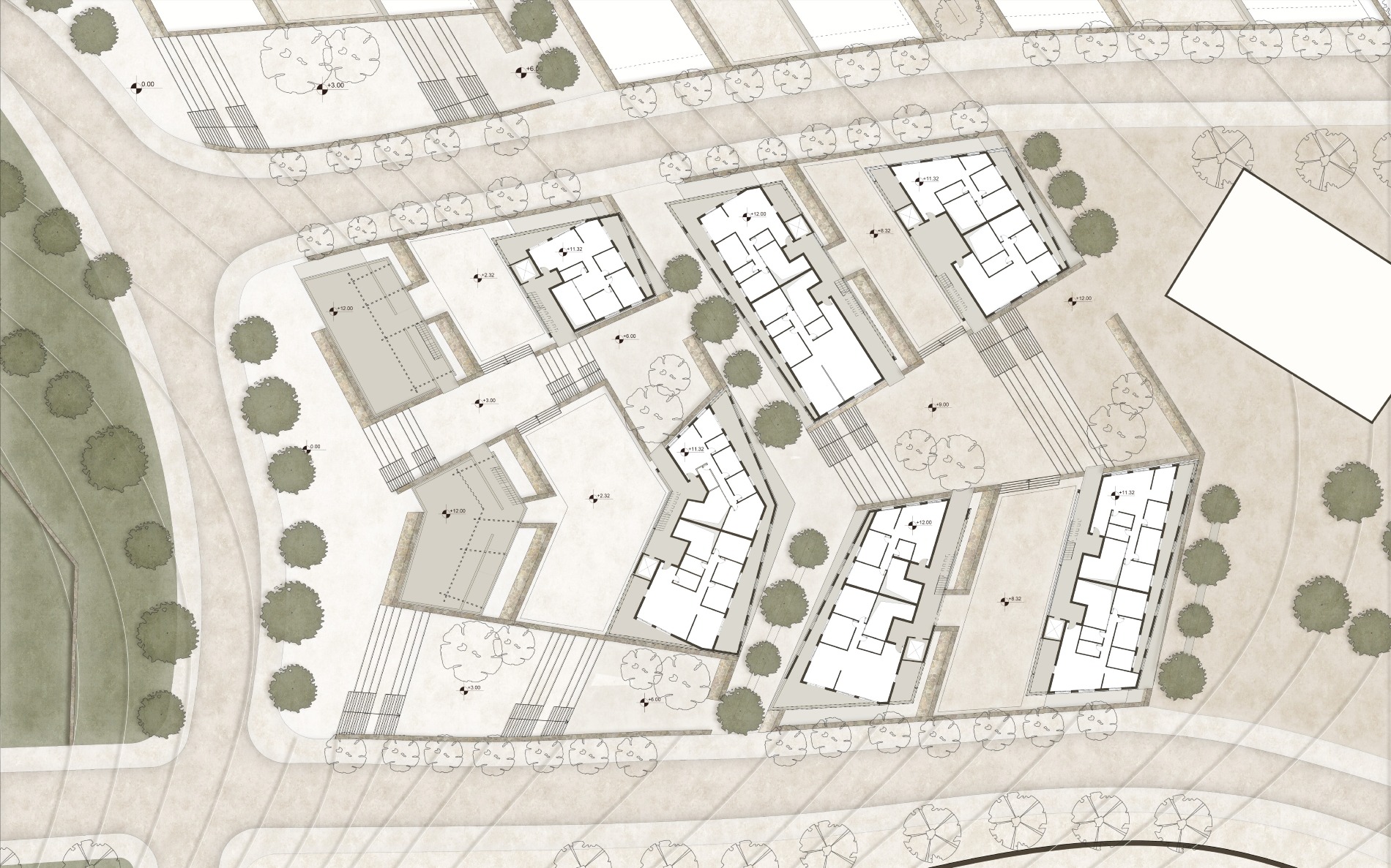
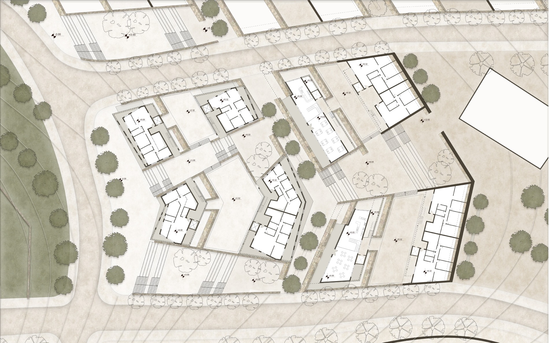
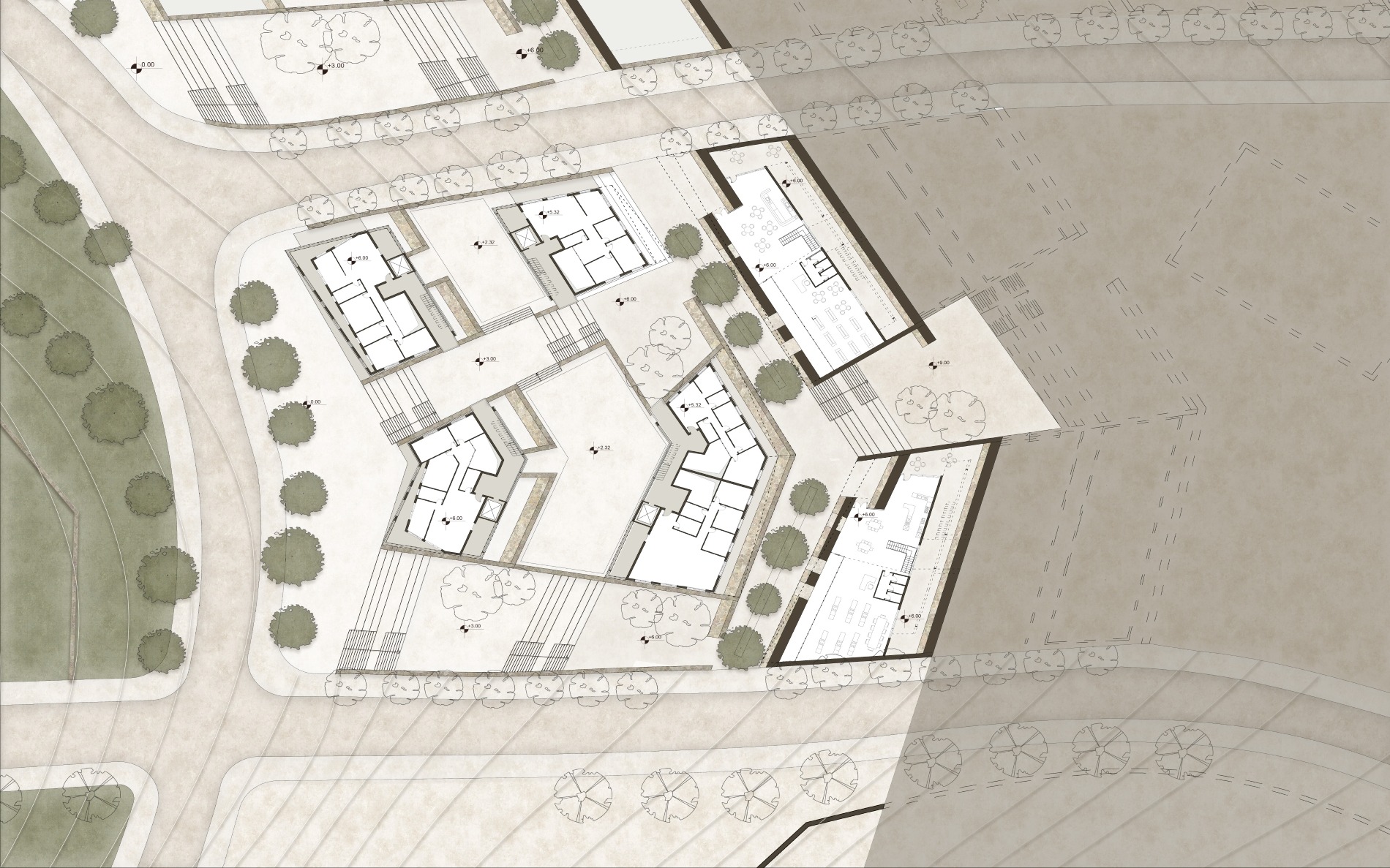
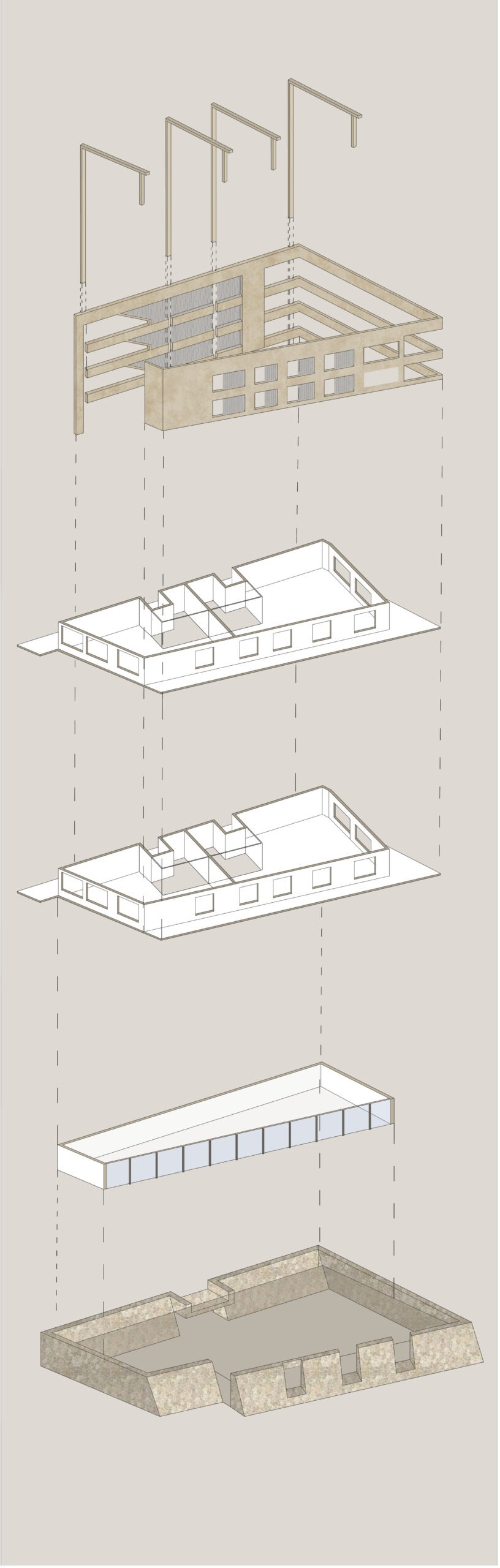
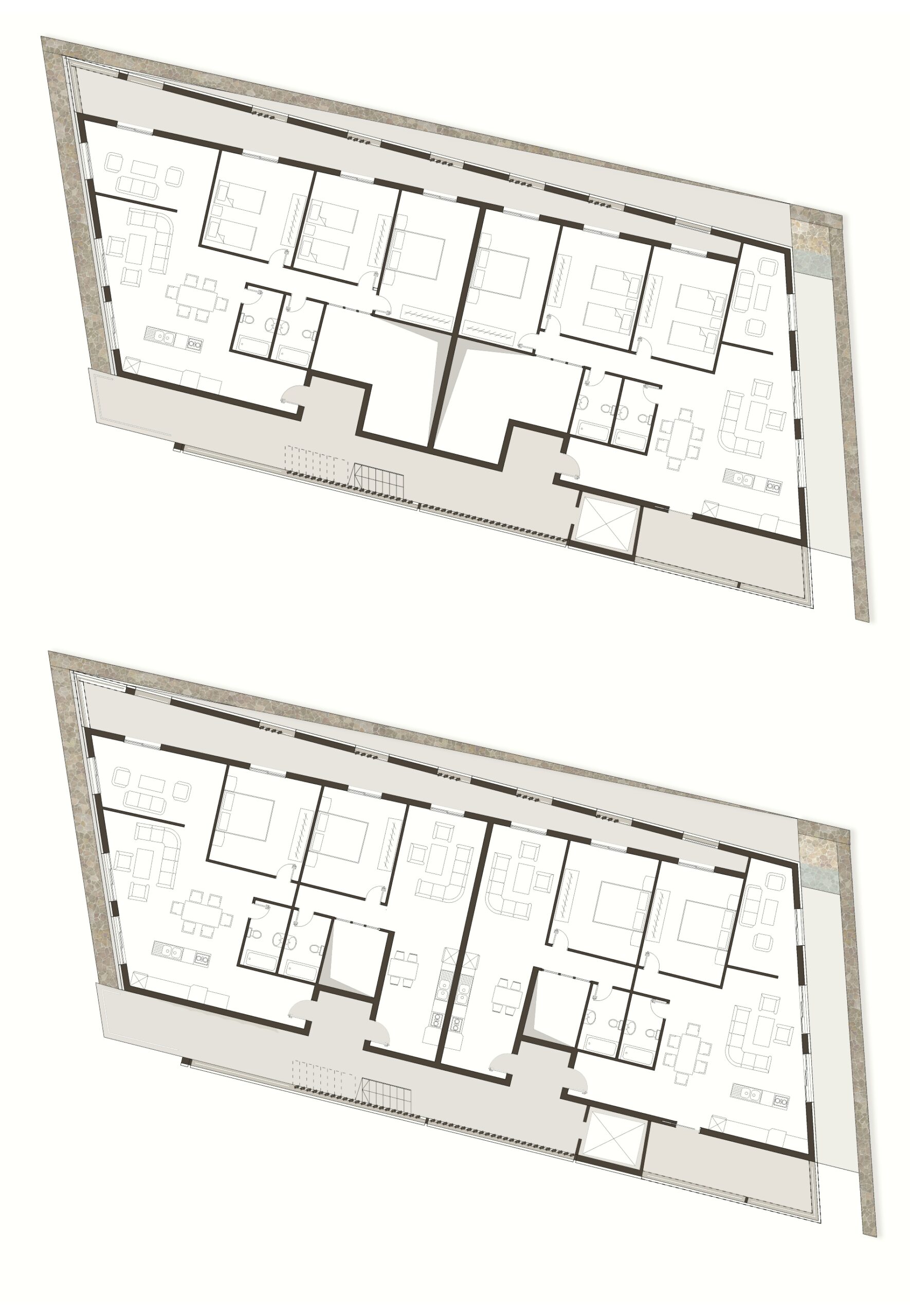
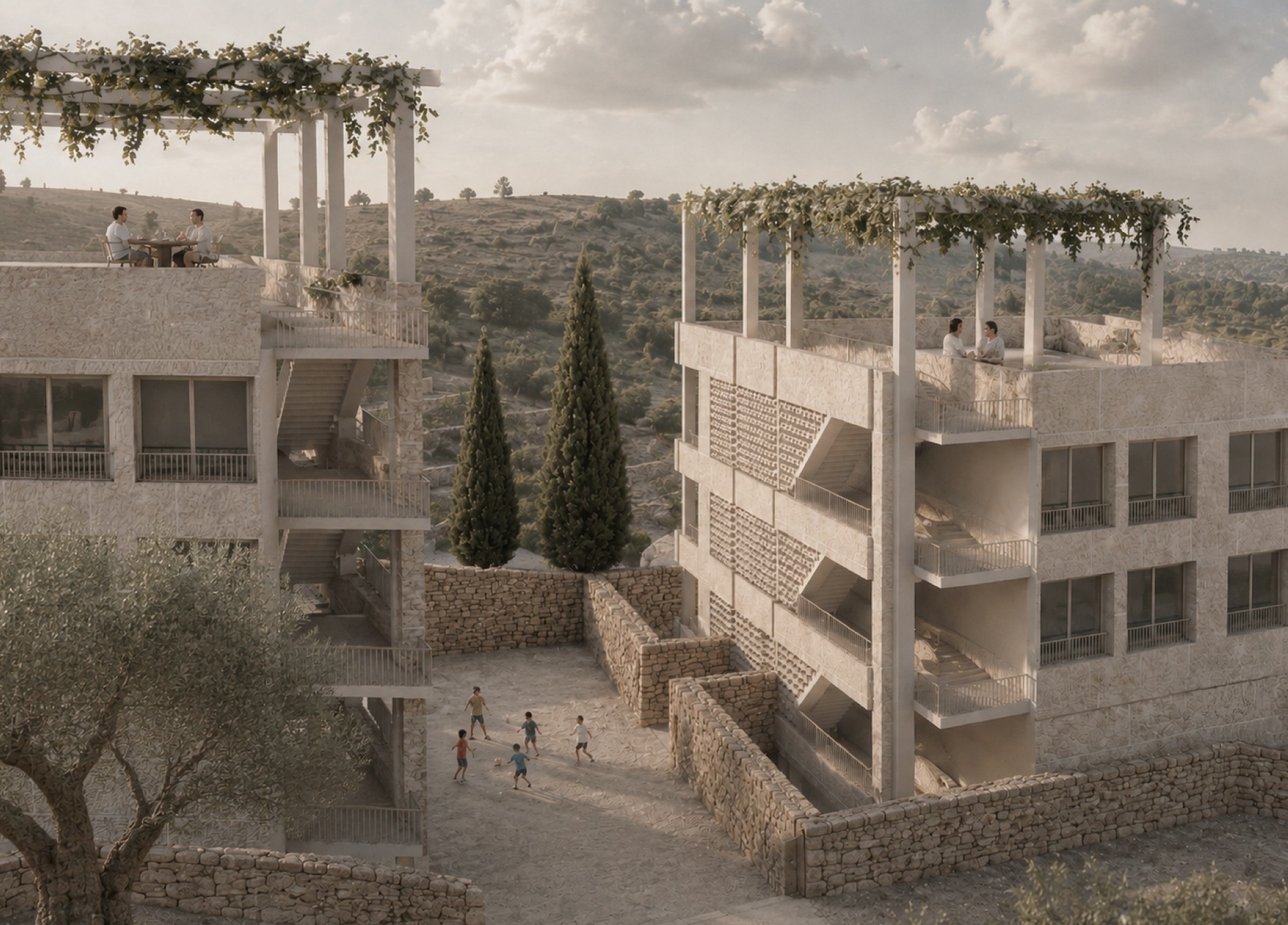
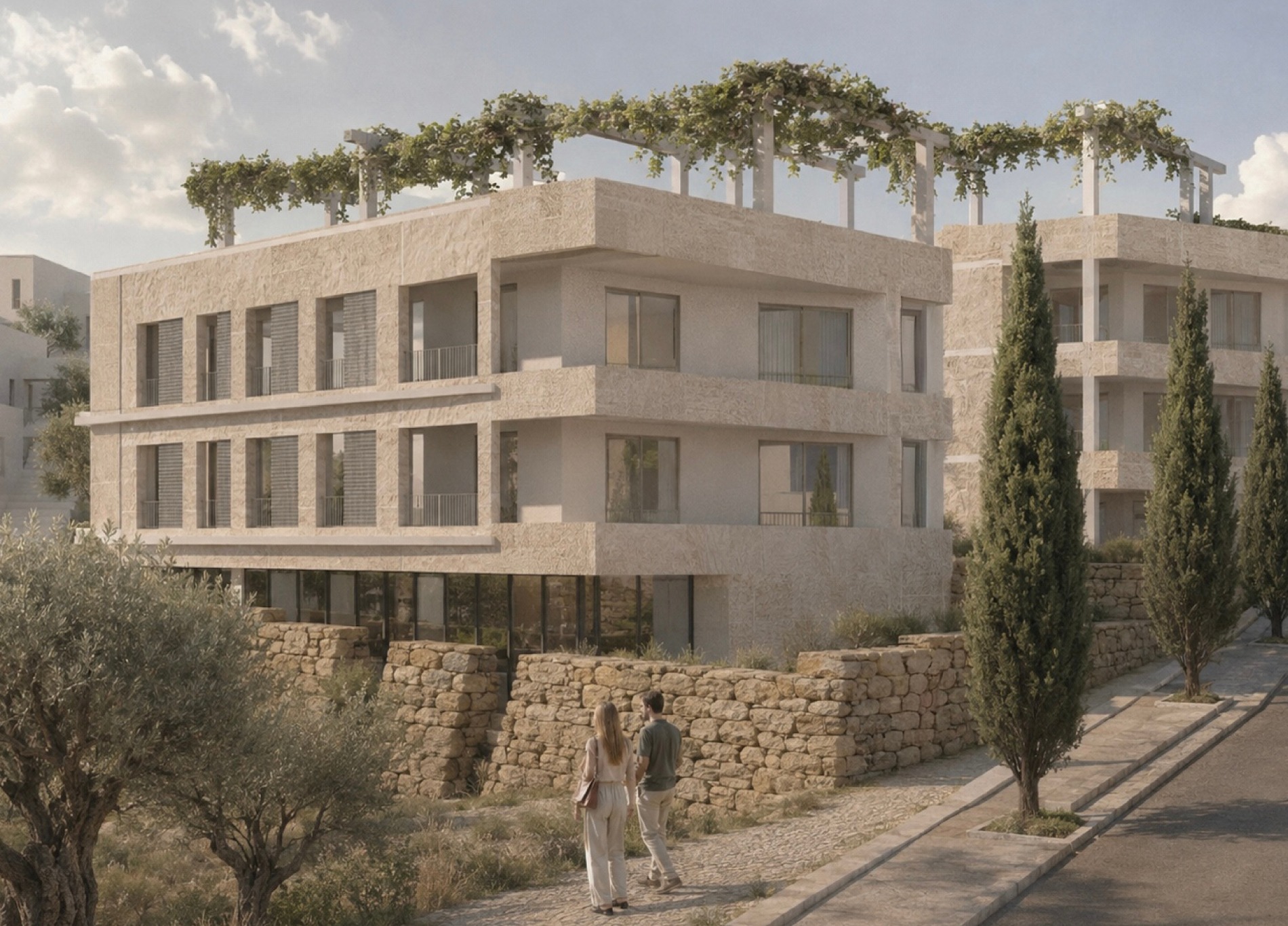
הפרויקט מזהה את המרחב המוזנח שבין המרקם העירוני לשטח הירוק המוגבל כאזור לימינאלי ומגדיר אותו מחדש כשכבת חיבור פעילה. הוא הופך את המרכיבים שתרמו לניתוקה של השכונה להזדמנויות ליצירת קשר מחודש. באמצעות רשת של שבילים ממזרח למערב, יחידות מגורים חדשות ומרחבי תרבות ציבוריים, הפרויקט מחייה את הנוף באמצעות גישה אדריכלית הנשענת על הטופוגרפיה של האתר ועל אופיו המרחבי של א־טור. מיקום המבנים, פיתוח הטיפולוגיות האדריכליות ובחירת החומרים נתפסים כאסטרטגיות תכנון משולבות, המגיבות לתוואי הקרקע, מפרשות מחדש את הזהות התרבותית של השכונה ומחזקות את נוכחותה על המדרונות. יחד, התערבויות אלו תומכות בחיי הקהילה, משיבות את רציפות התנועה והמבט ומחברות מחדש את א־טור לסביבתה.
בסופו של דבר, ההצעה הופכת את רצועת השטח הירוקה מחומת הגבלה למרחב מתווך בין שימור לצמיחה. באמצעות פיתוח השוליים הללו, הפרויקט משיב לא־טור את נוכחותה על ההר ויוצר מסגרת מאוחדת לחיבור חברתי, תרבותי ועירוני.
Located on the slopes of the Mount of Olives, A-Tur is shaped by the tension between its historic landscape and modern urban restrictions. For decades, the Green Belt—a planning policy rooted in the British Mandate—has limited the neighborhood’s expansion, prioritizing the Old City’s skyline over local development needs. This has led to inward growth, extreme density, a shortage of housing, and a growing disconnection from the western slopes that once shaped the village’s identity, diminishing its presence on the mountain.
The project identifies the neglected edge between the urban fabric and the restricted green space as a liminal zone, reimagined as an active connective layer. It transforms the elements that have contributed to the neighborhood’s disconnection into opportunities for reconnection. Through a network of east–west paths, new residential units, and public cultural spaces, the project reactivates the landscape through an architectural approach rooted in the site’s topography and the spatial character of A-Tur. The positioning of buildings, the development of architectural typologies, and the selection of materials are conceived as interconnected design strategies that respond to the terrain, reinterpret the neighborhood’s cultural identity, and reinforce its presence on the slopes. Together, these interventions support community life, restore movement and visual continuity, and reconnect A-Tur to its surroundings.
Ultimately, the proposal transforms the Green Belt from a wall of restriction into a spatial mediator between preservation and growth. By building upon this edge, the project restores A-Tur’s presence on the mountain and establishes a unified framework for social, cultural, and urban connection.
تقع بلدة الطور على سفوح جبل الزيتون، وتتشكّل هويتها بفعل التوتر بين مشهدها التاريخي وقيود التخطيط الحضري المعاصرة. على مدى عقود، حدّ الحزام الأخضر” the green belt” — وهو توجّه تخطيطي تعود جذوره إلى فترة الانتداب البريطاني — من توسّع الحي، مقدّمًا الحفاظ على أفق البلدة القديمة على احتياجات التطور لدى المجتمع المحلي. وقد أدّى ذلك إلى نموّ الحي نحو الداخل، ارتفاع الكثافة العمرانية، نقص المساكن، وتزايد انفصاله عن السفوح الغربية التي تشكّل جزءًا أساسيًا من هوية القرية، فنتج عن ذلك تراجع حضور الحي على الجبل.
يحدّد المشروع الحافة المهملة بين النسيج العمراني والمساحة الخضراء المقيّدة بوصفها منطقة بينيّة "Liminal Zone"، ويعيد تصوّرها كطبقة ربط فاعلة، ويحوّل العناصر التي ساهمت في عزل الحي إلى فرص لإعادة الاتصال. من خلال شبكة من المسارات الممتدة من الشرق إلى الغرب، وحدات سكنية جديدة، ومساحات ثقافية عامة، يعيد المشروع تنشيط المشهد الطبيعي عبر مقاربة معمارية تنطلق من طبوغرافية الموقع والطابع المكاني للطور. كما ان تموضع المباني، وتطوير الأنماط المعمارية، واختيار المواد المستخدمة في التنفيذ هي استراتيجيات تصميم مترابطة تستجيب لتضاريس الأرض، وتعيد تأويل الهوية الثقافية للحي، وتعزّز حضوره على السفوح. وتساهم هذه التدخلات مجتمعةً في دعم الحياة المجتمعية، واستعادة استمرارية الحركة والرؤية، وإعادة ربط الطور بمحيطها.
في نهاية المطاف، يحوّل المقترح الحزام الأخضر من جدارٍ للقيود إلى حيّز وسيط بين الحفاظ والتطوّر. ومن خلال البناء على هذه الحافة، يستعيد المشروع حضور الطور على الجبل، ويؤسّس إطارًا متكاملًا للترابط الاجتماعي والثقافي والعمراني.